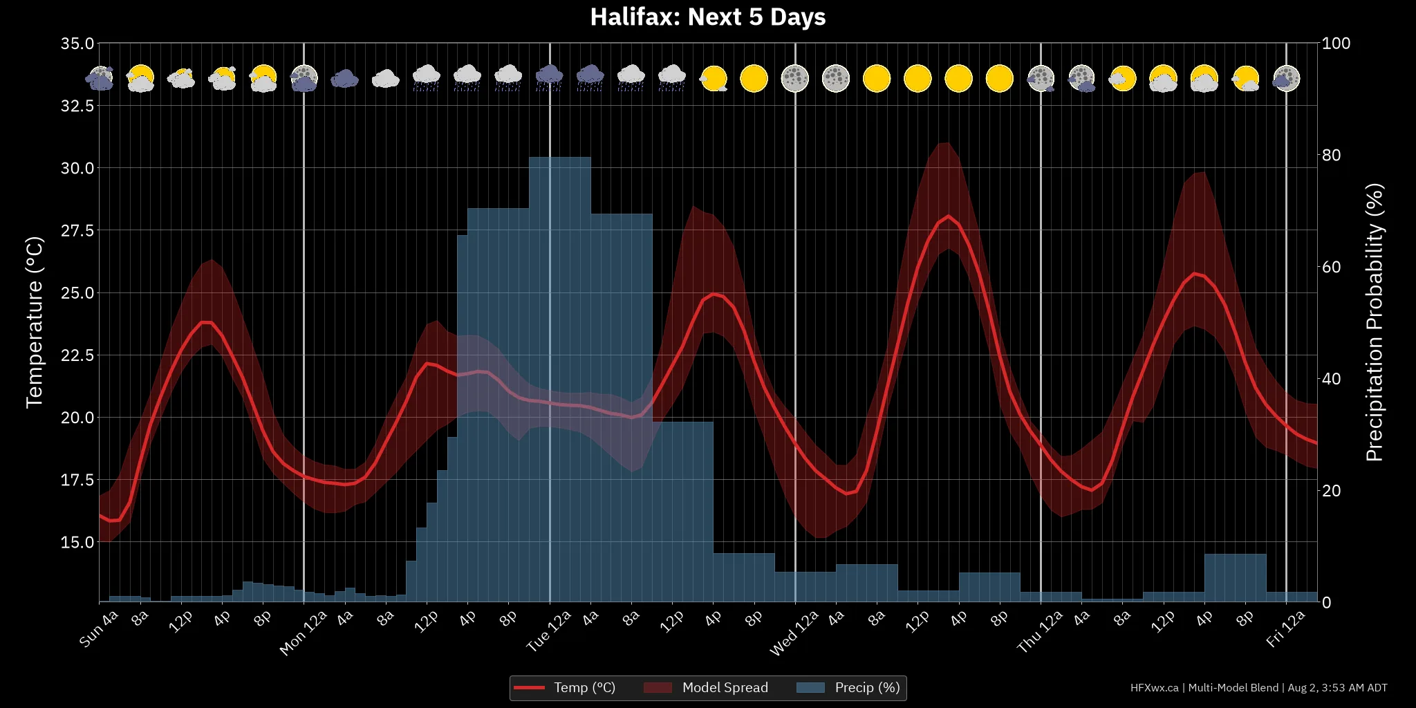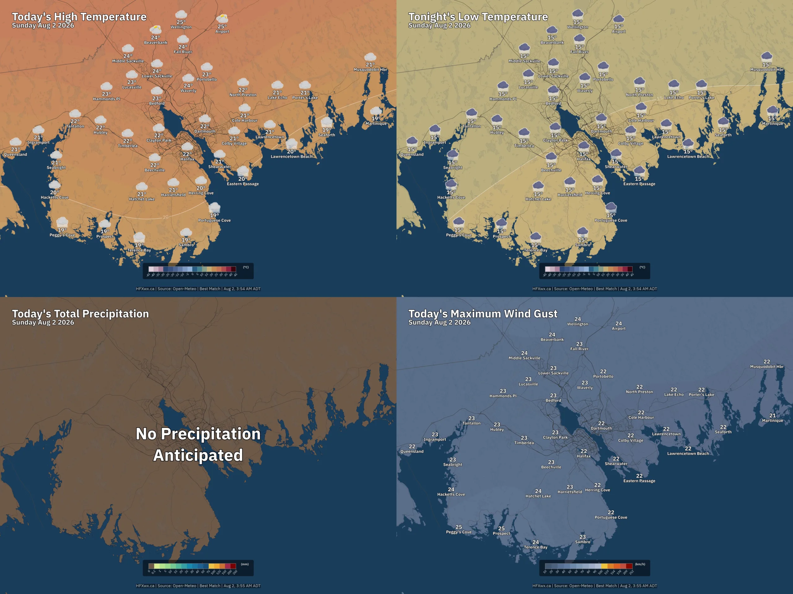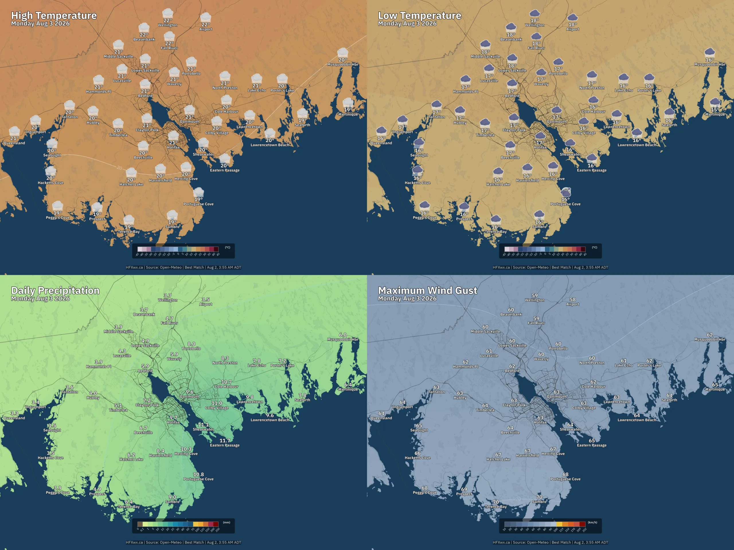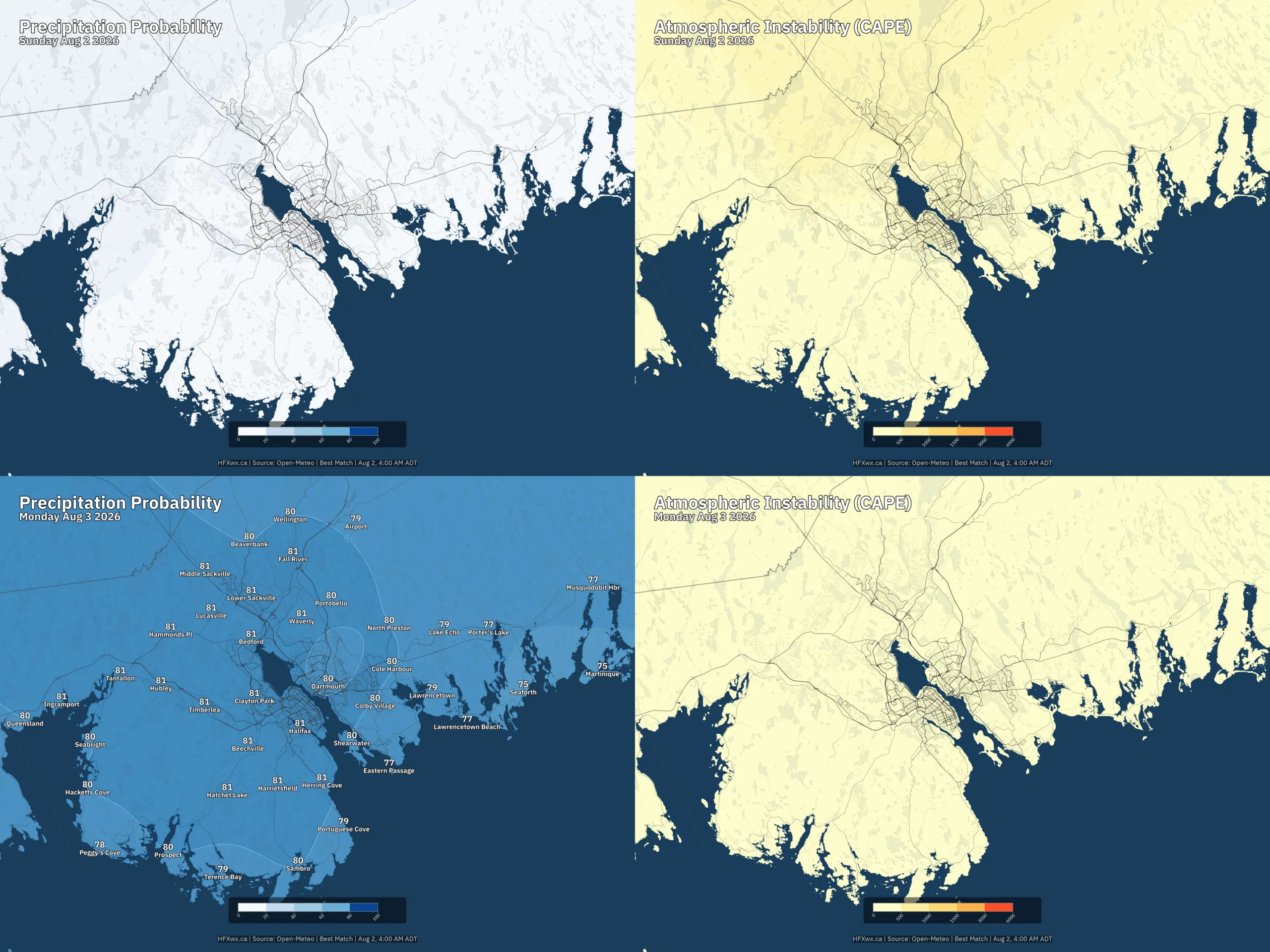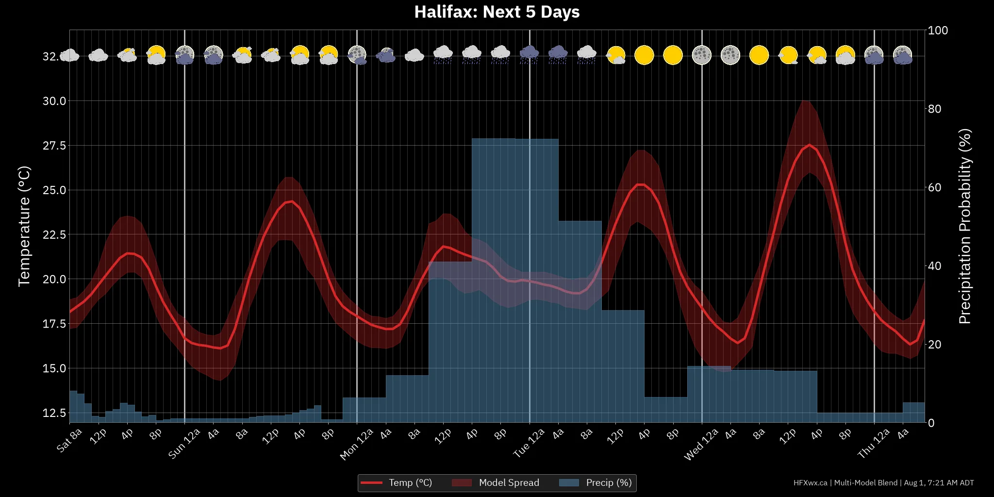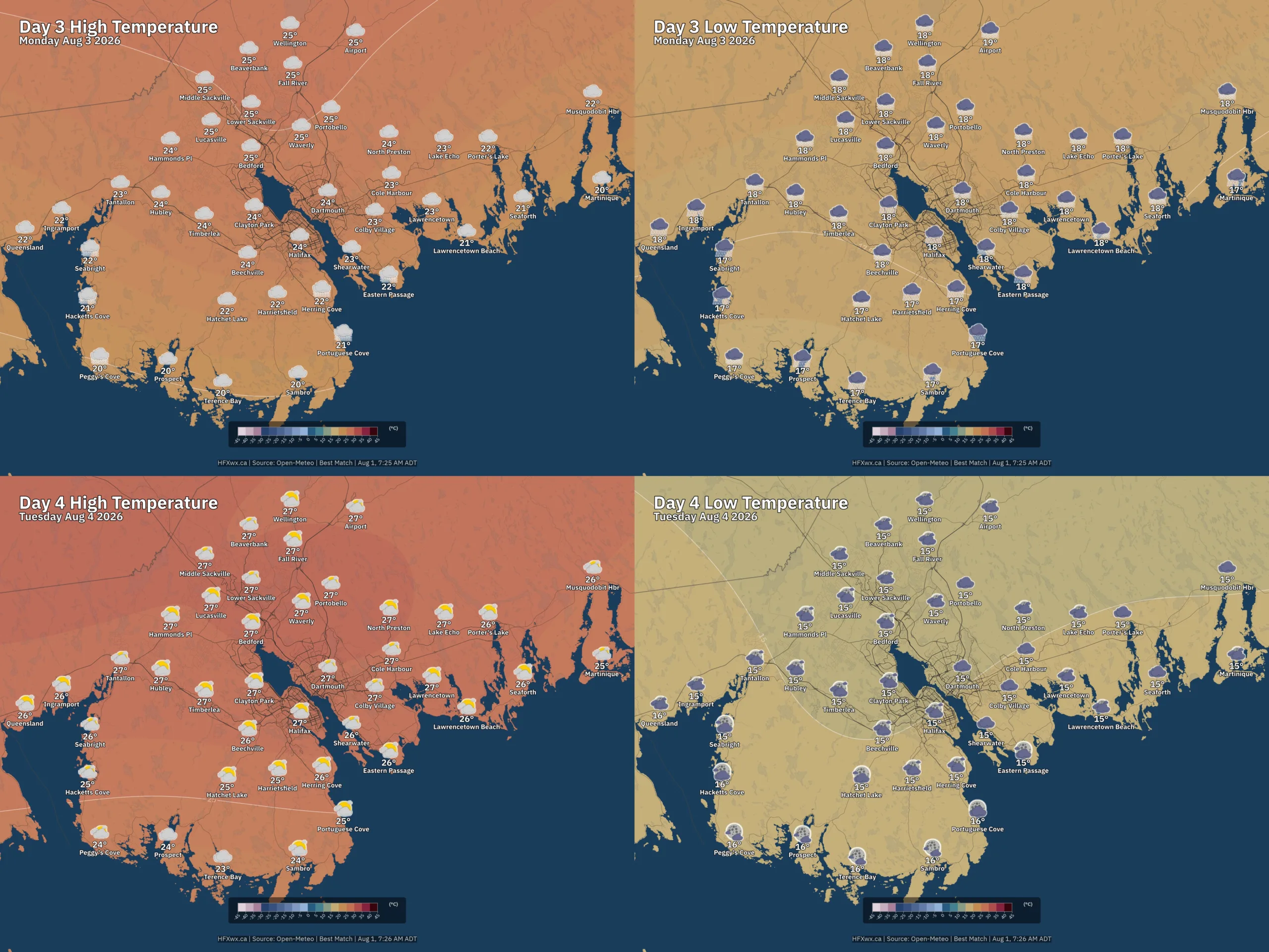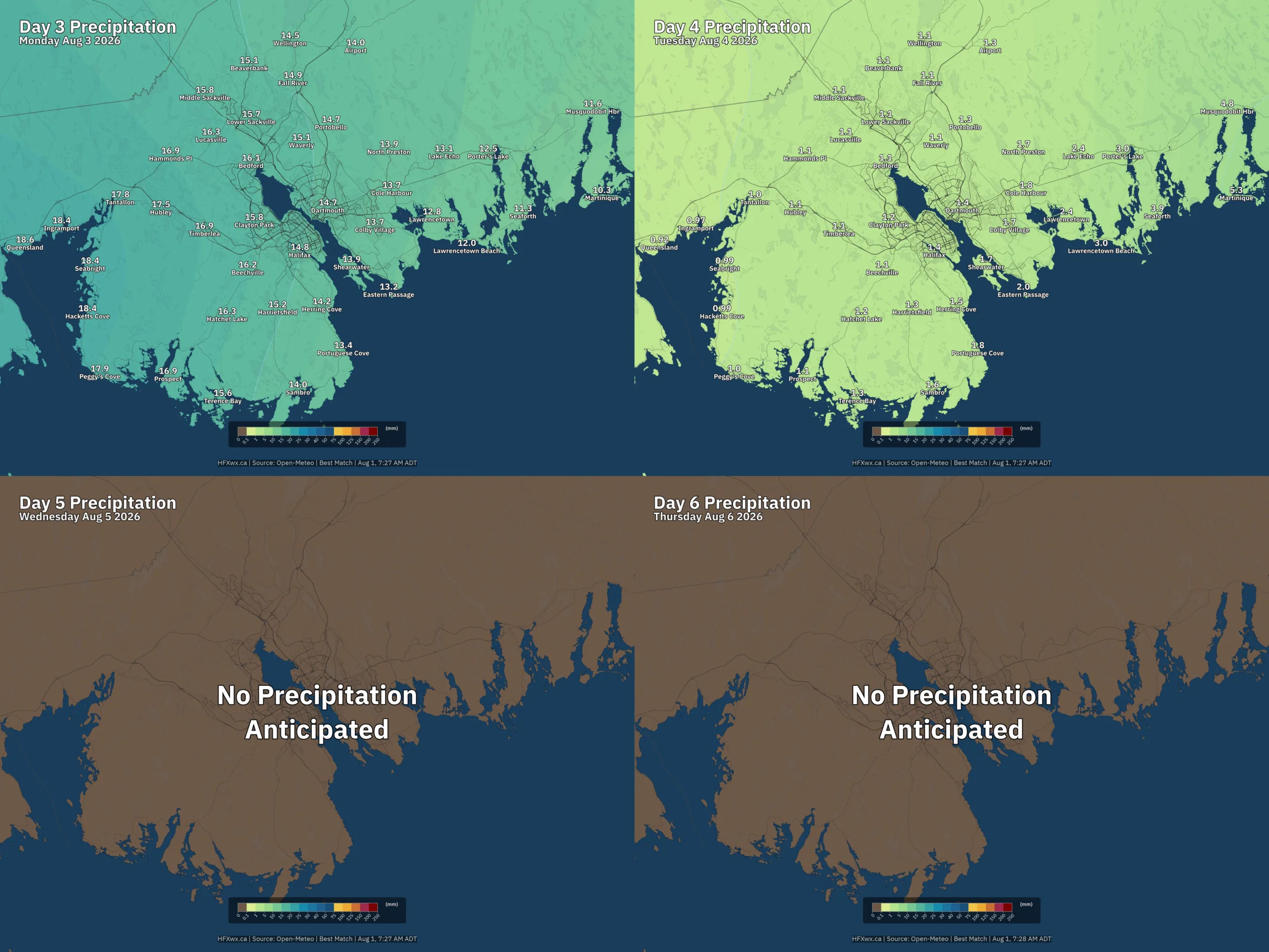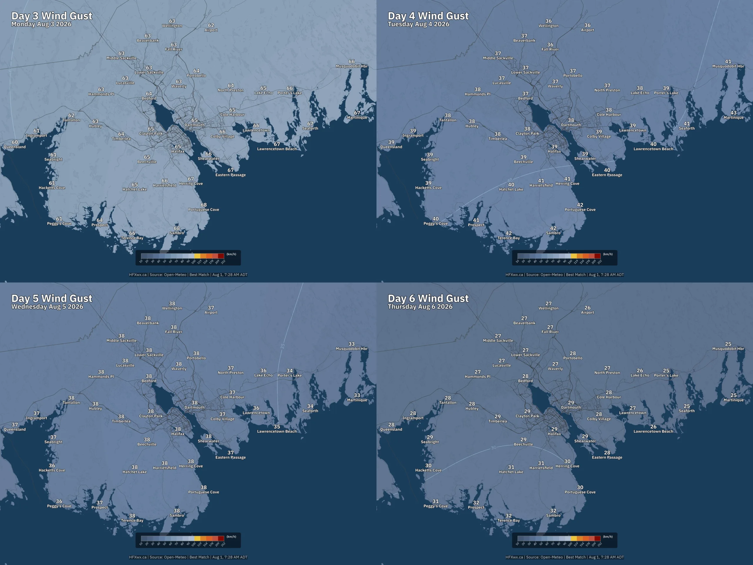
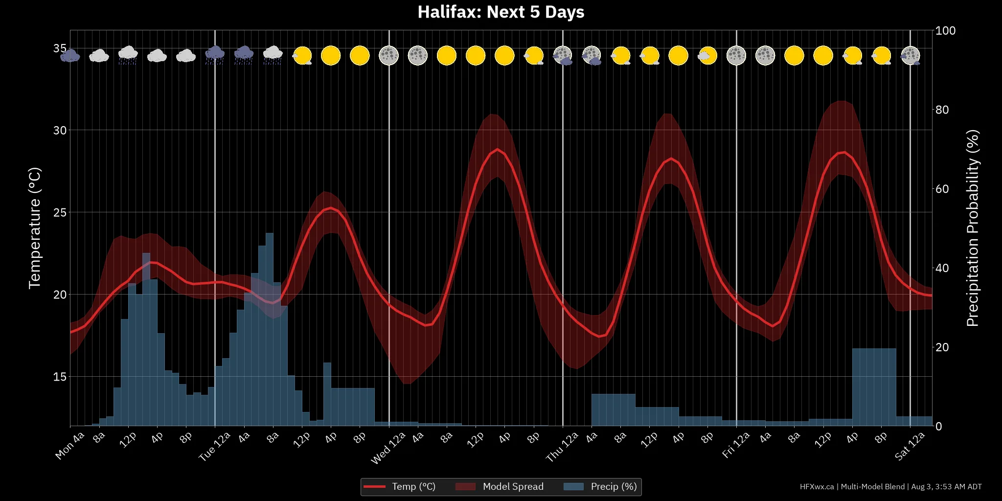
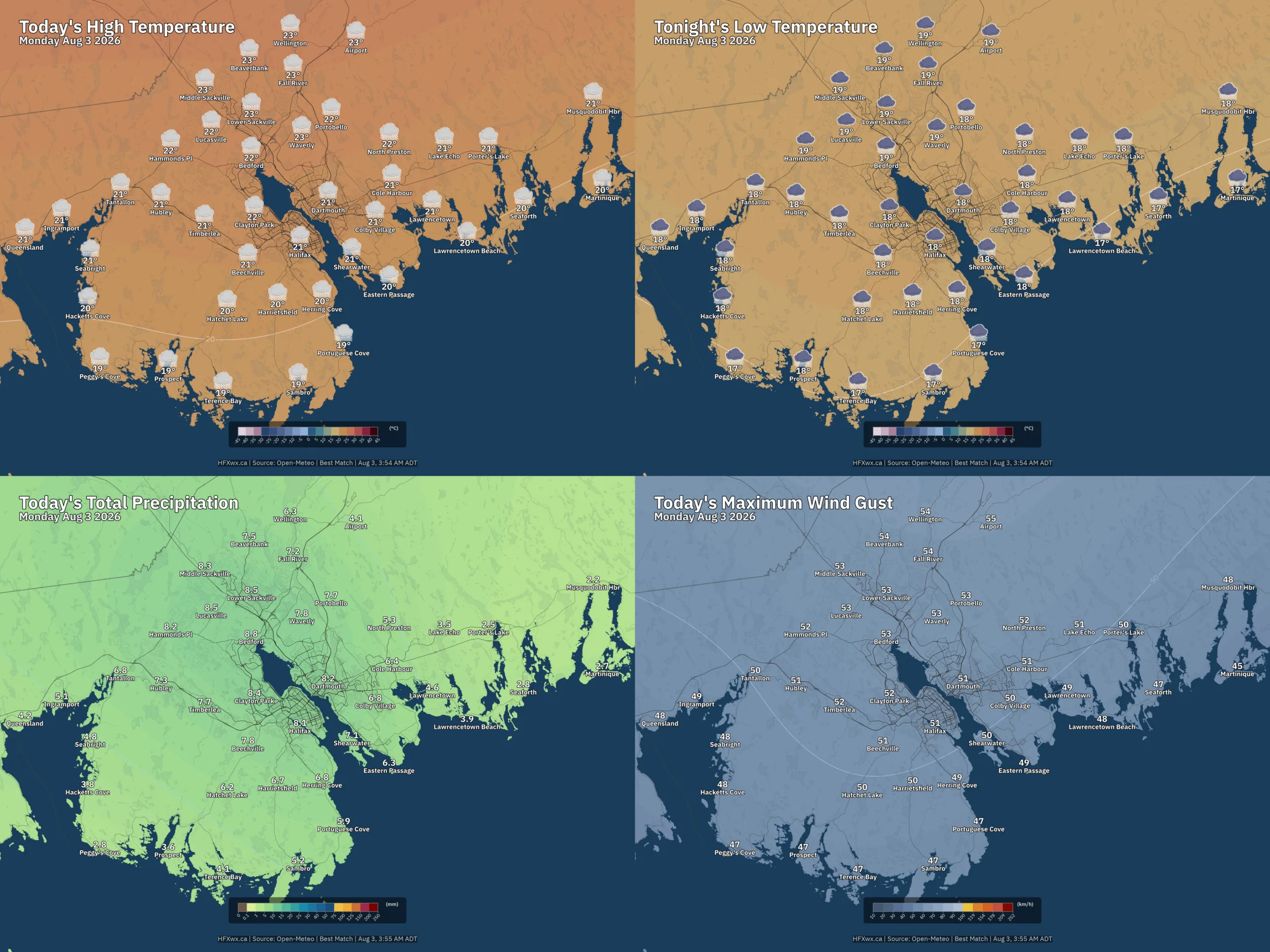
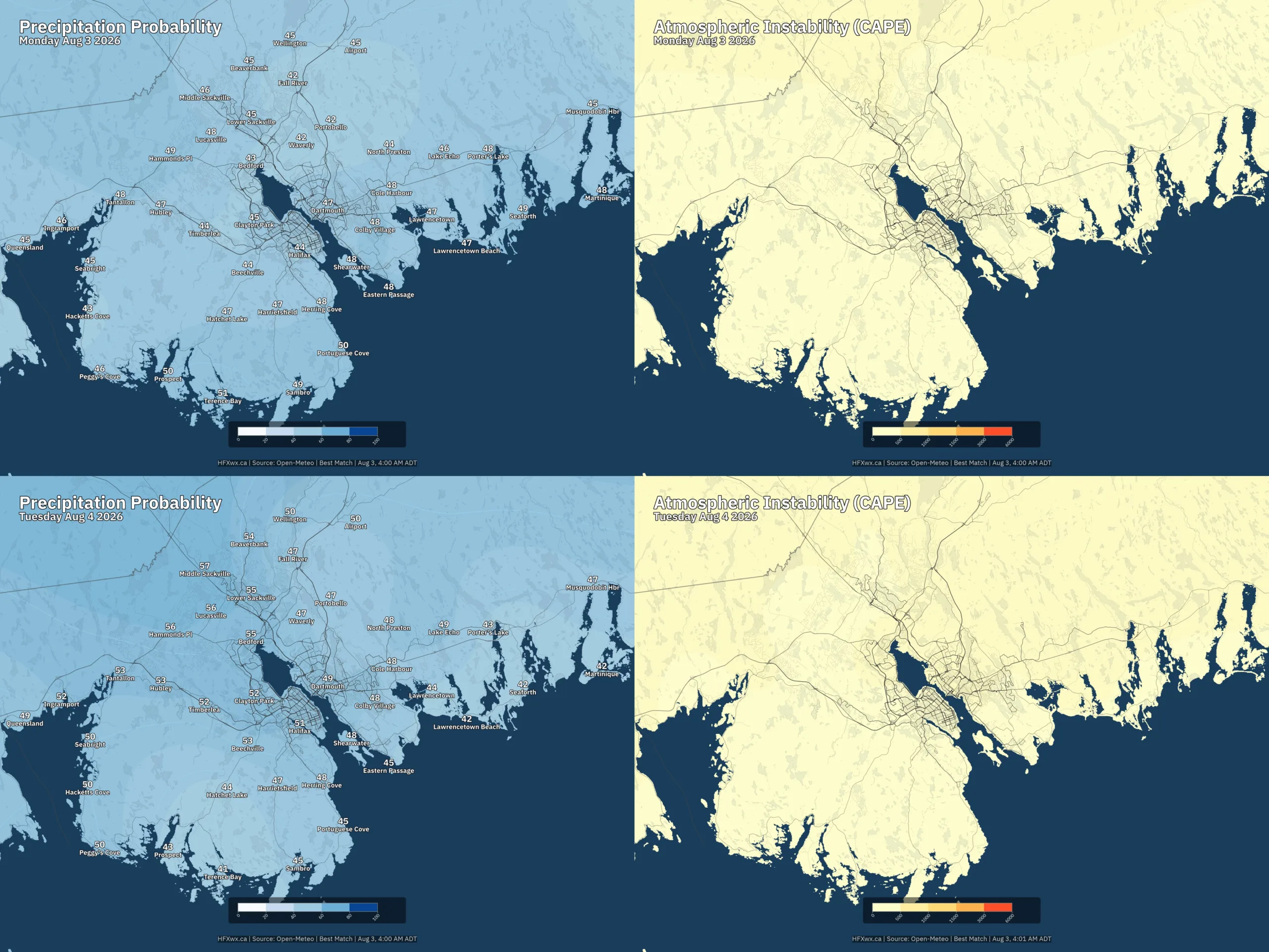
Today (Aug 3): Overcast skies this morning. Near 19°C (high dew point, muggy). This afternoon, overcast skies, near 22°C (high dew point, muggy), SE becoming S winds 20 km/h gusting to 35. Rain (43% POP) this afternoon (3mm). Fog patches dissipating by morning. Expect cloudy skies this evening. Near 21°C (high dew point, muggy), S winds 20 km/h gusting to 40. Scattered Rain (48% POP) overnight to tomorrow morning (5mm). Cloudy skies tonight with lows near 20°C (high dew point, very muggy), S becoming SSW winds 30 km/h gusting to 55.
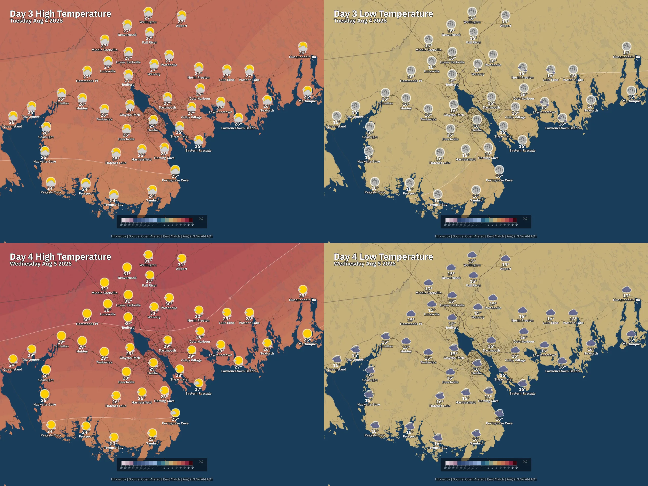
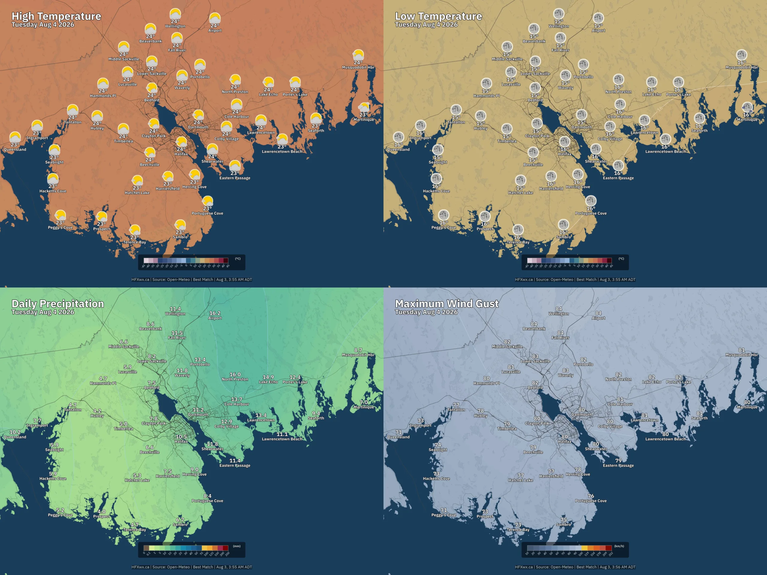
Tomorrow (Aug 4): Anticipate scattered clouds Tuesday morning. Near 20°C (high dew point, muggy), SSW becoming WSW winds 30 km/h gusting to 50. Tuesday afternoon brings clear skies. Near 24°C (elevated dew point), WSW winds 25 km/h gusting to 50. Clear skies Tuesday evening. Near 22°C, WSW becoming W winds 25 km/h gusting to 45.
📅 Today:

Dew point 18° (humid)
Dew point 19° (humid)
36% POP
UV: 3 (Mod)
Rain: 1.4 mm
Dew point 19° (humid)
44% POP
UV: 5 (Mod)
Rain: 1.6 mm
Dew point 19° (humid)
Dew point 20° (muggy)
Rain: 1.4 mm
📜 Today’s Almanac:
Today: -1.6°
Today: +3.1°
HALIFAX, 1925
CHAIN LAKE, 1956
HALIFAX, 1943
📅 Tomorrow:
Dew point 19° (humid)
39% POP
Rain: 2.1 mm
Feels like 18°
Dew point 18° (humid)
49% POP
Rain: 1.6 mm

Feels like 21°
Dew point 16°
UV: 7 (High)

Feels like 23°
UV: 7 (High)
Feels like 21°
UV: 3 (Mod)

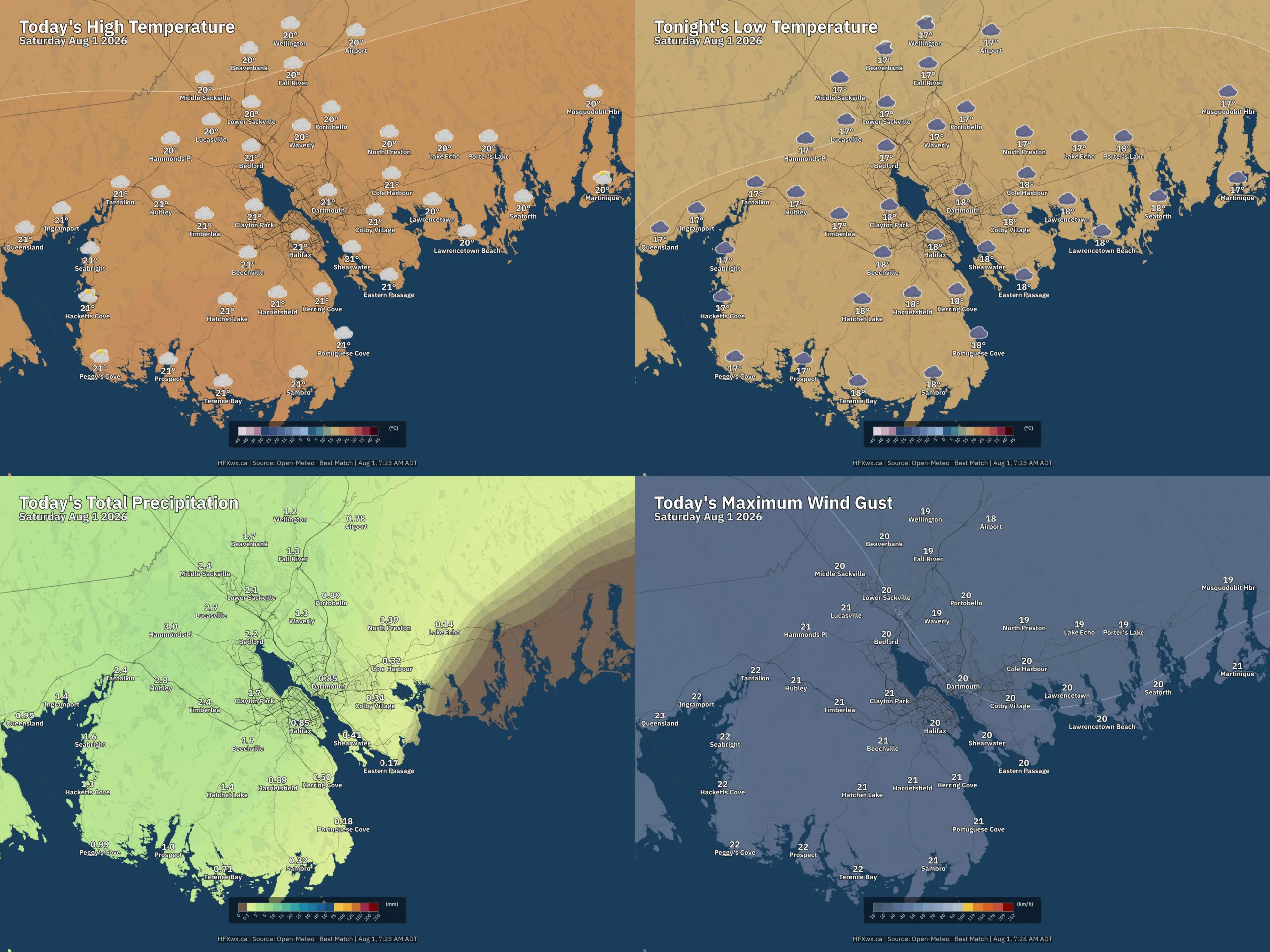
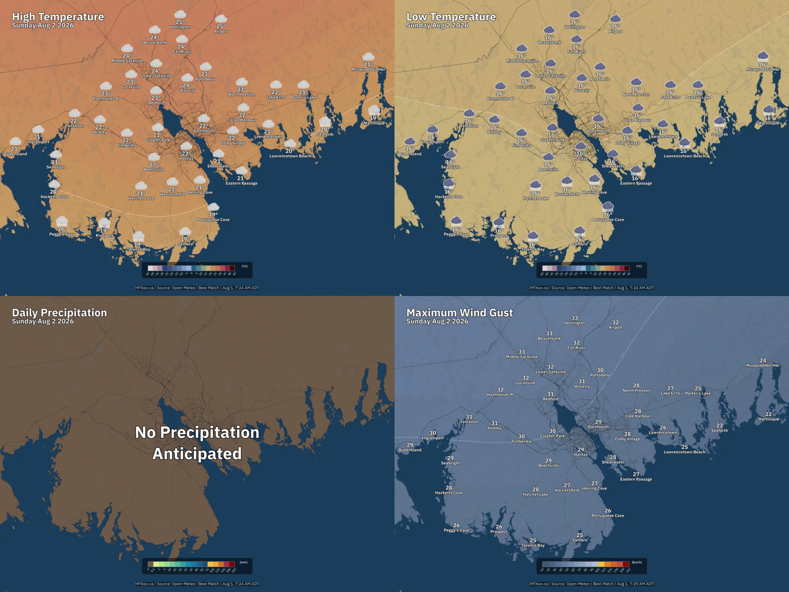
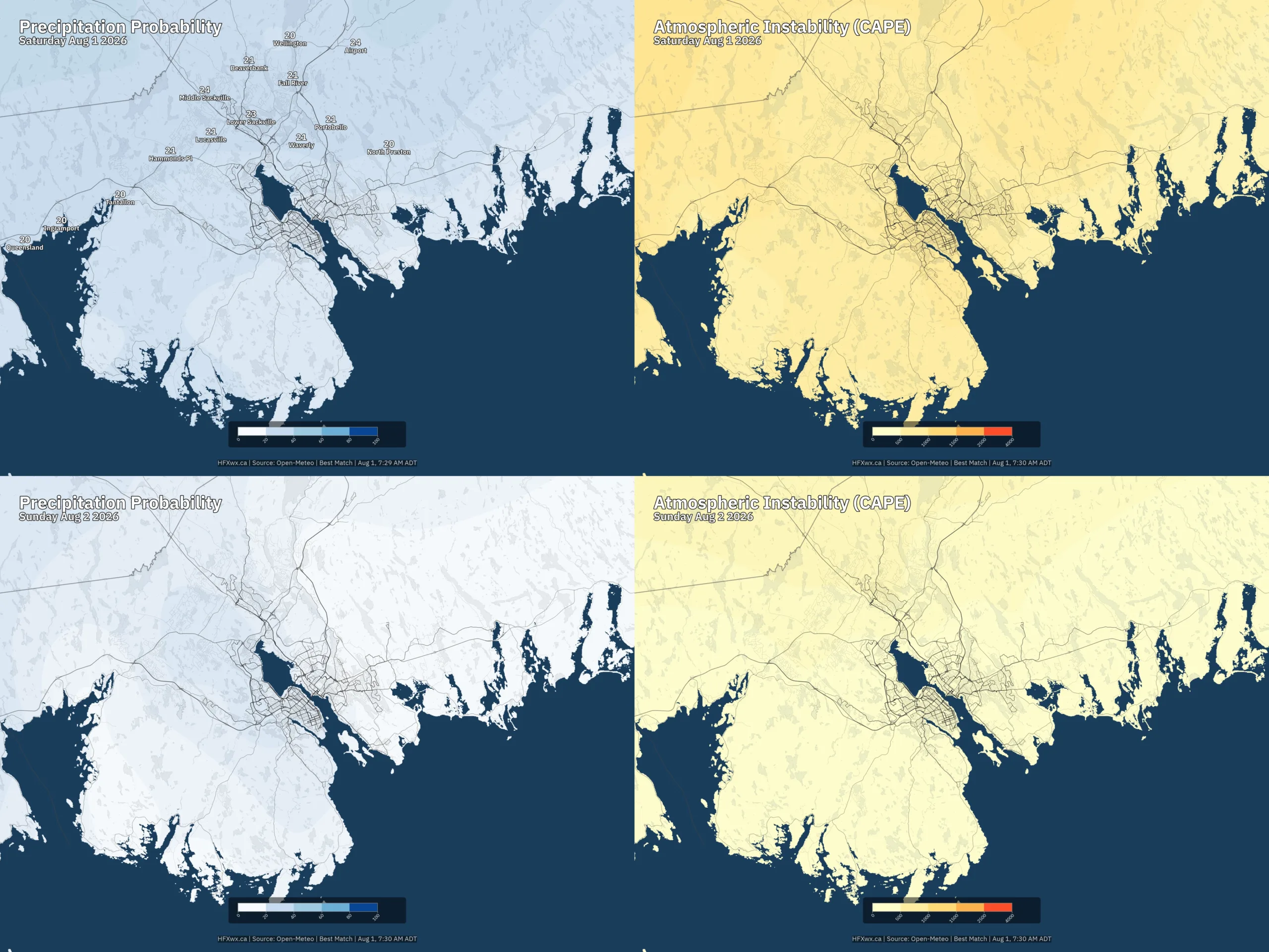
🗺️ Today and Tomorrow:
🗓️ Outlook:
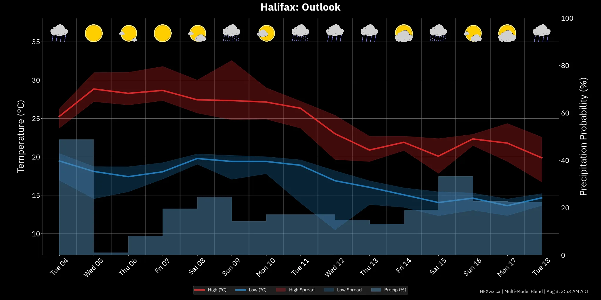
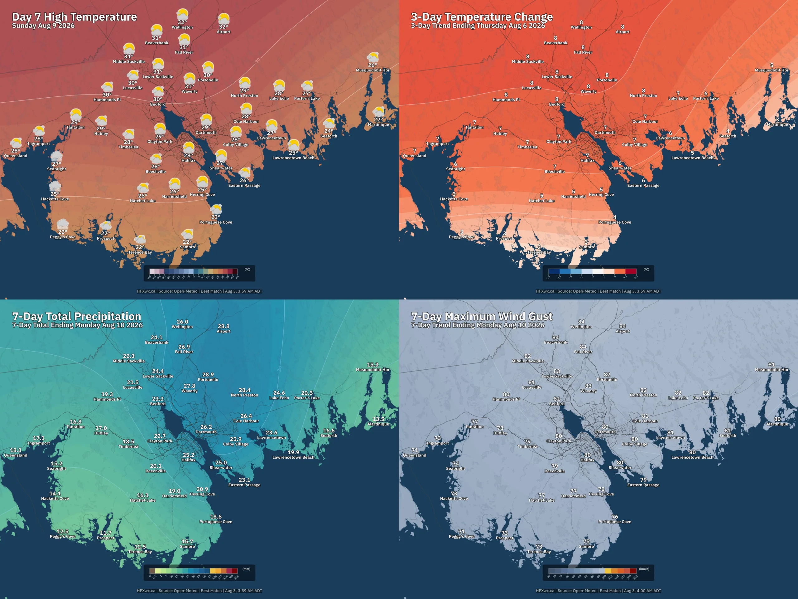
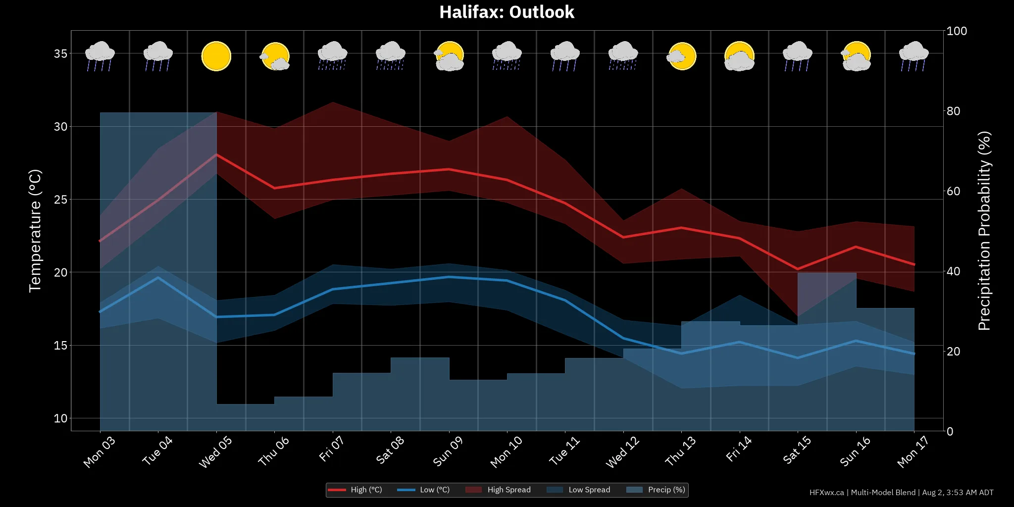
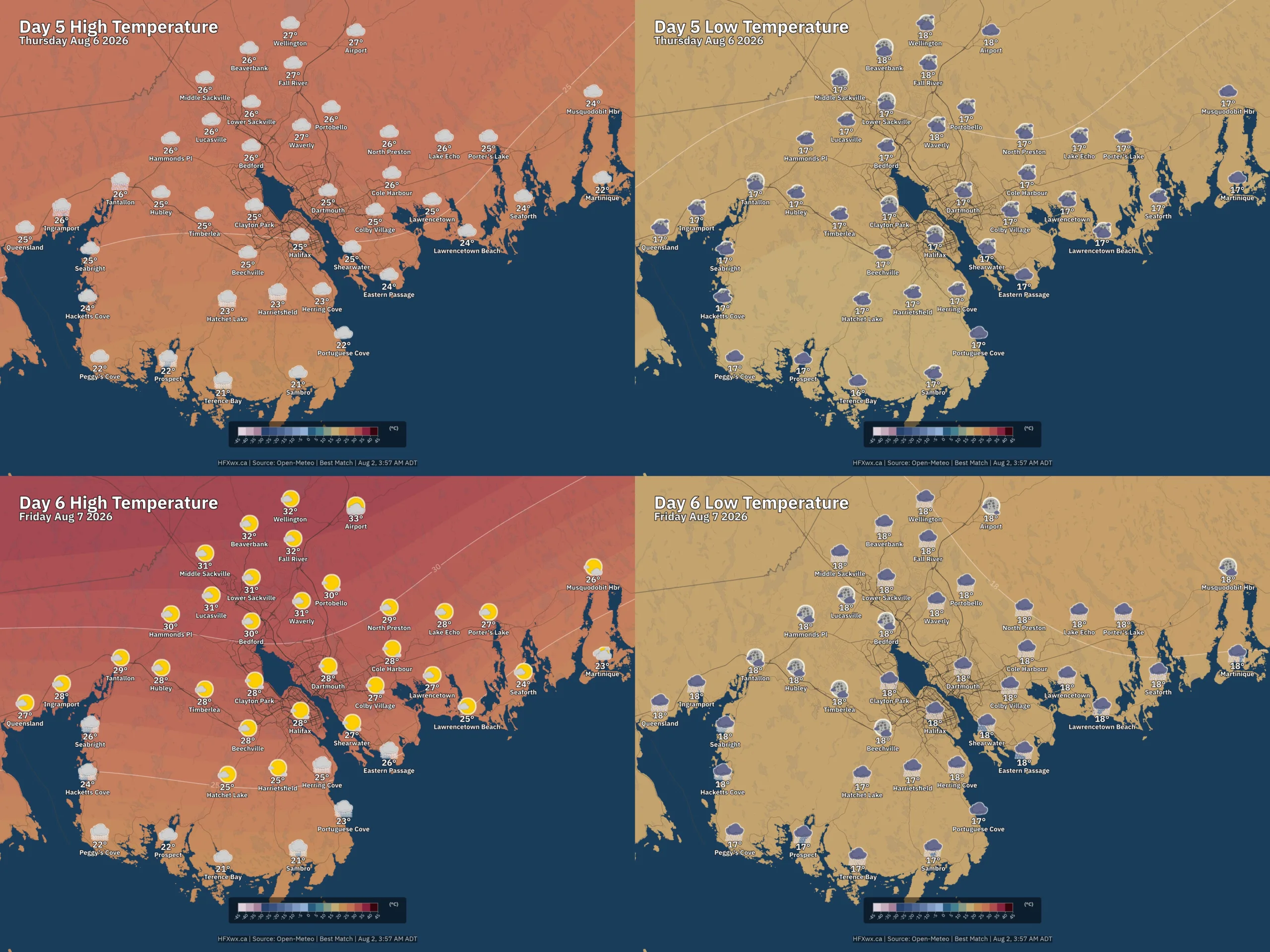
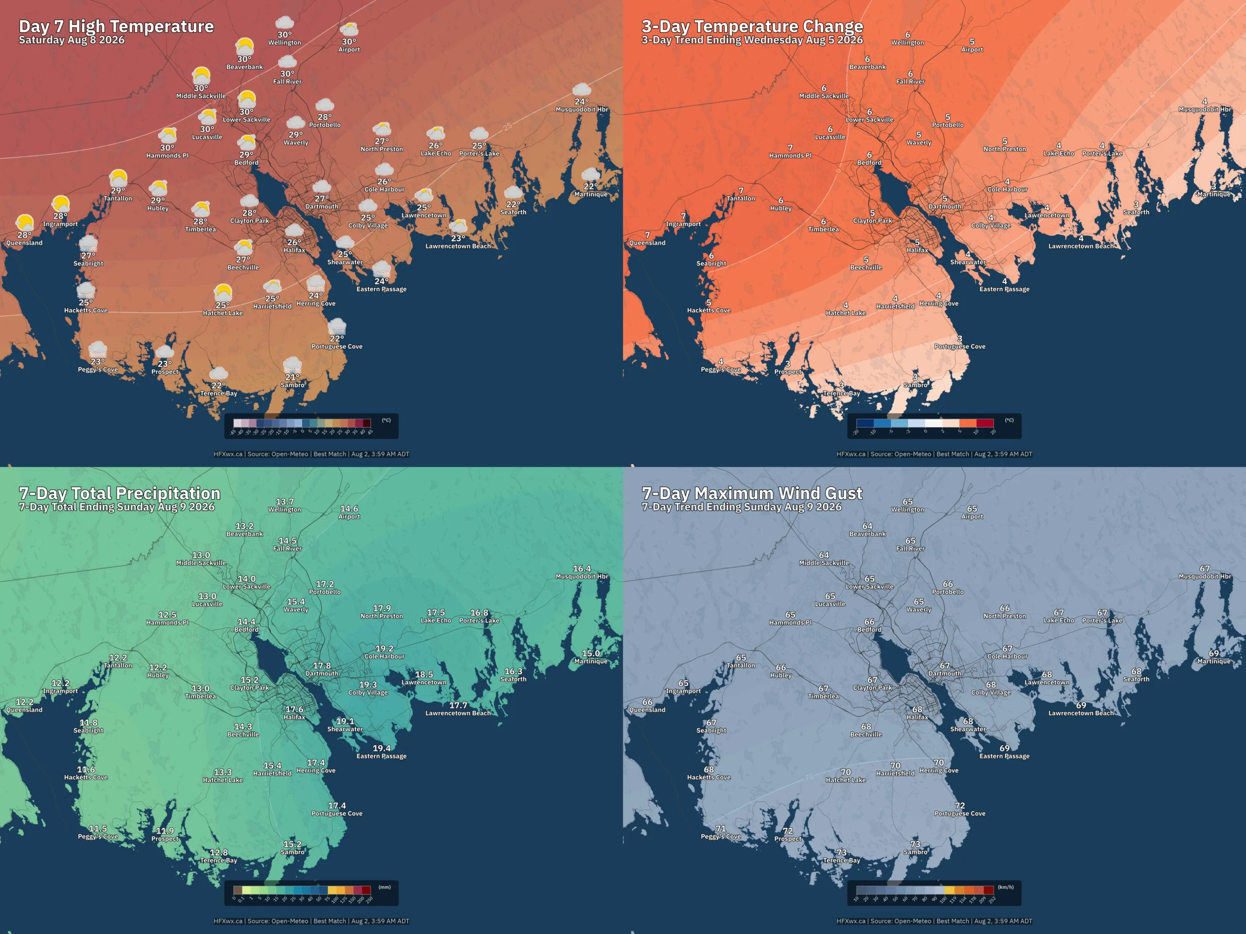
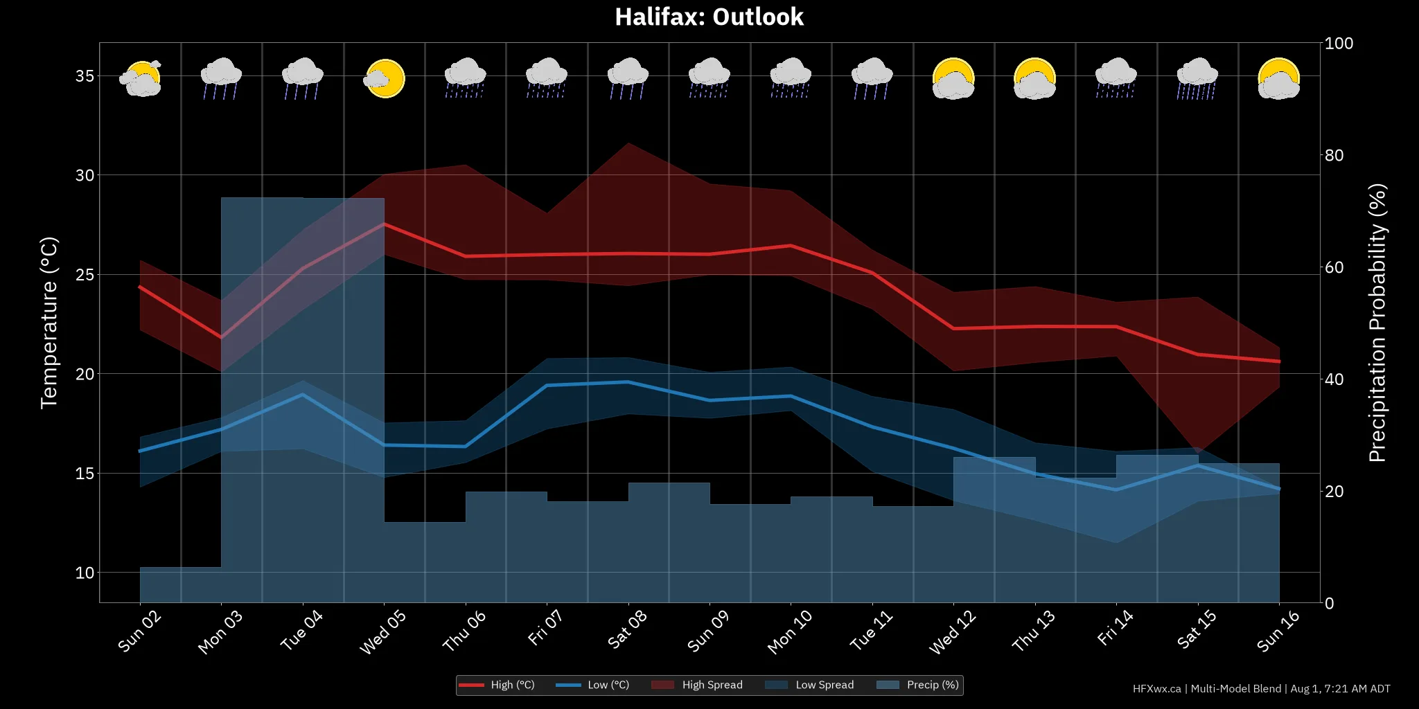
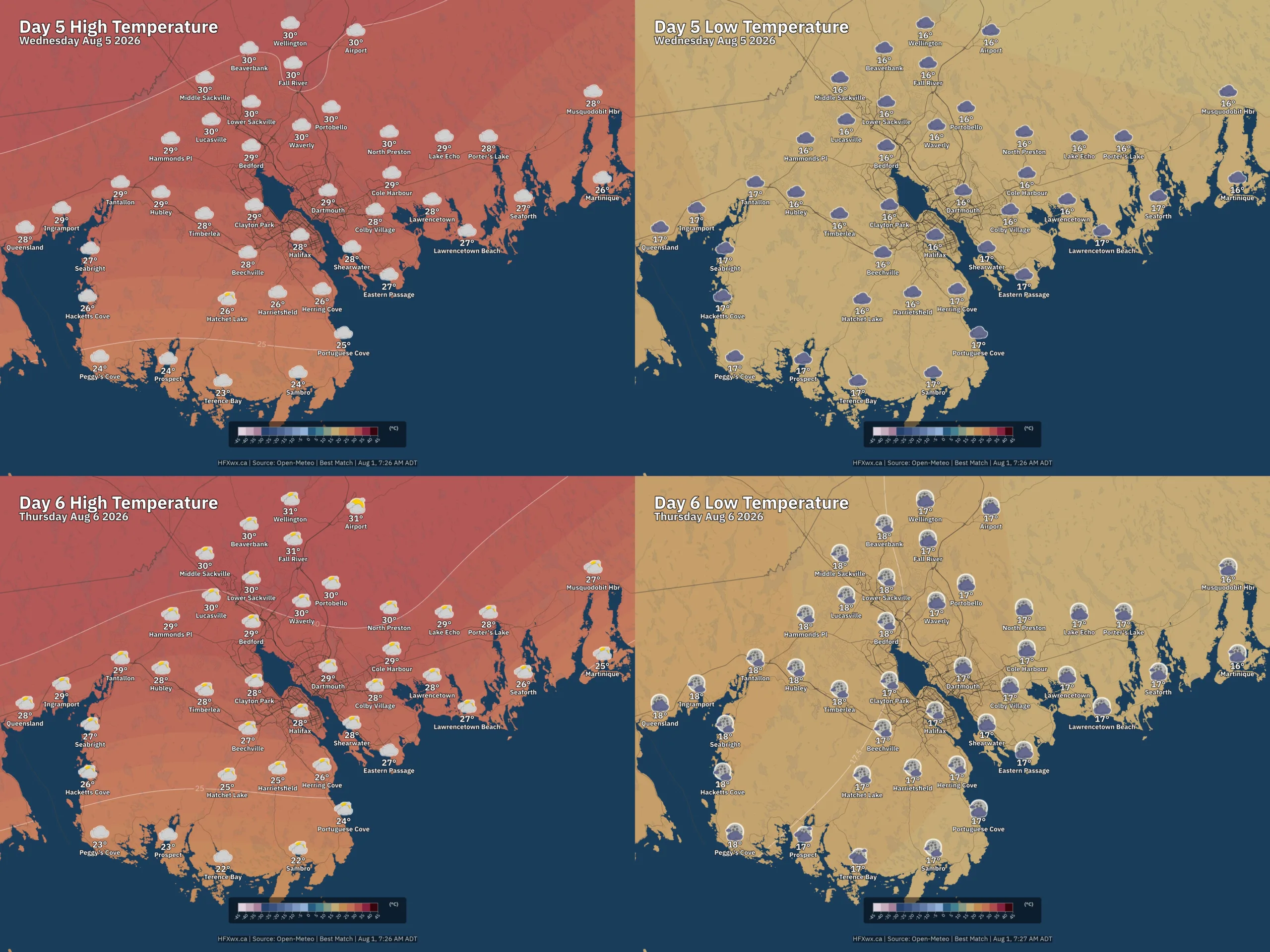
Unseasonably warm pattern (+4.1°C anomaly) with moderate confidence for the extended period. Expect Showers Sun 9, Showers Tue 11, and Light rain Tue 18.
Model Divergence: Model divergence on short-term rainfall: amounts range from 0.00 to 10.78 mm. Model spread on Wed Aug 12 rainfall: 0.00 to 10.61 mm. Model uncertainty on Sun Aug 9 highs: 25 to 33°C.
Ensembles indicate a cooler trend beyond day 14.
Feels like 31°
Feels like 31°

Feels like 31°
Rain: 1.2 mm

Feels like 29°
Rain: 1.3 mm
Rain: 2.8 mm
Rain: 6.2 mm

33% POP
Rain: 1.1 mm
Feels like 23°
Rain: 8.7 mm
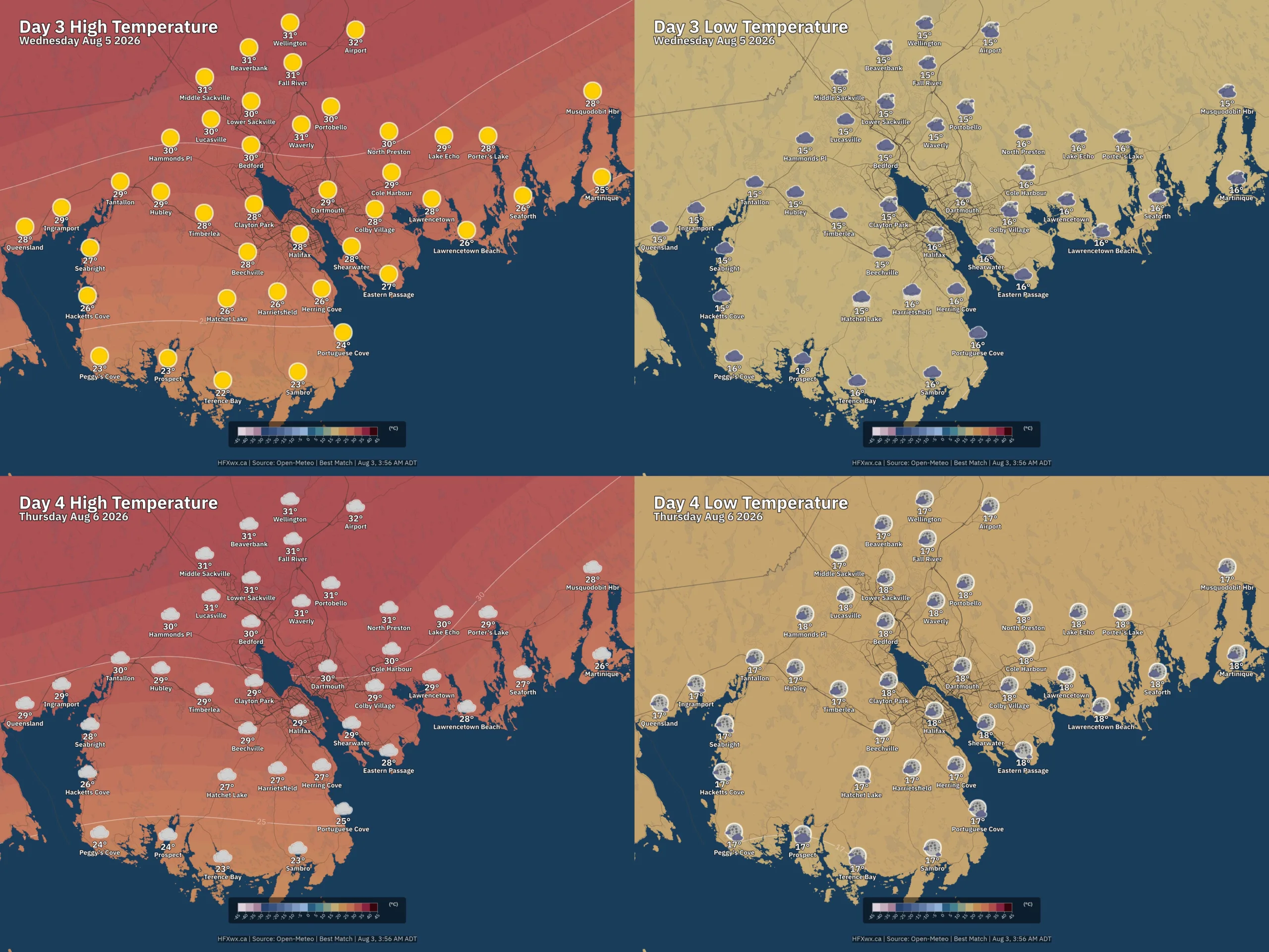
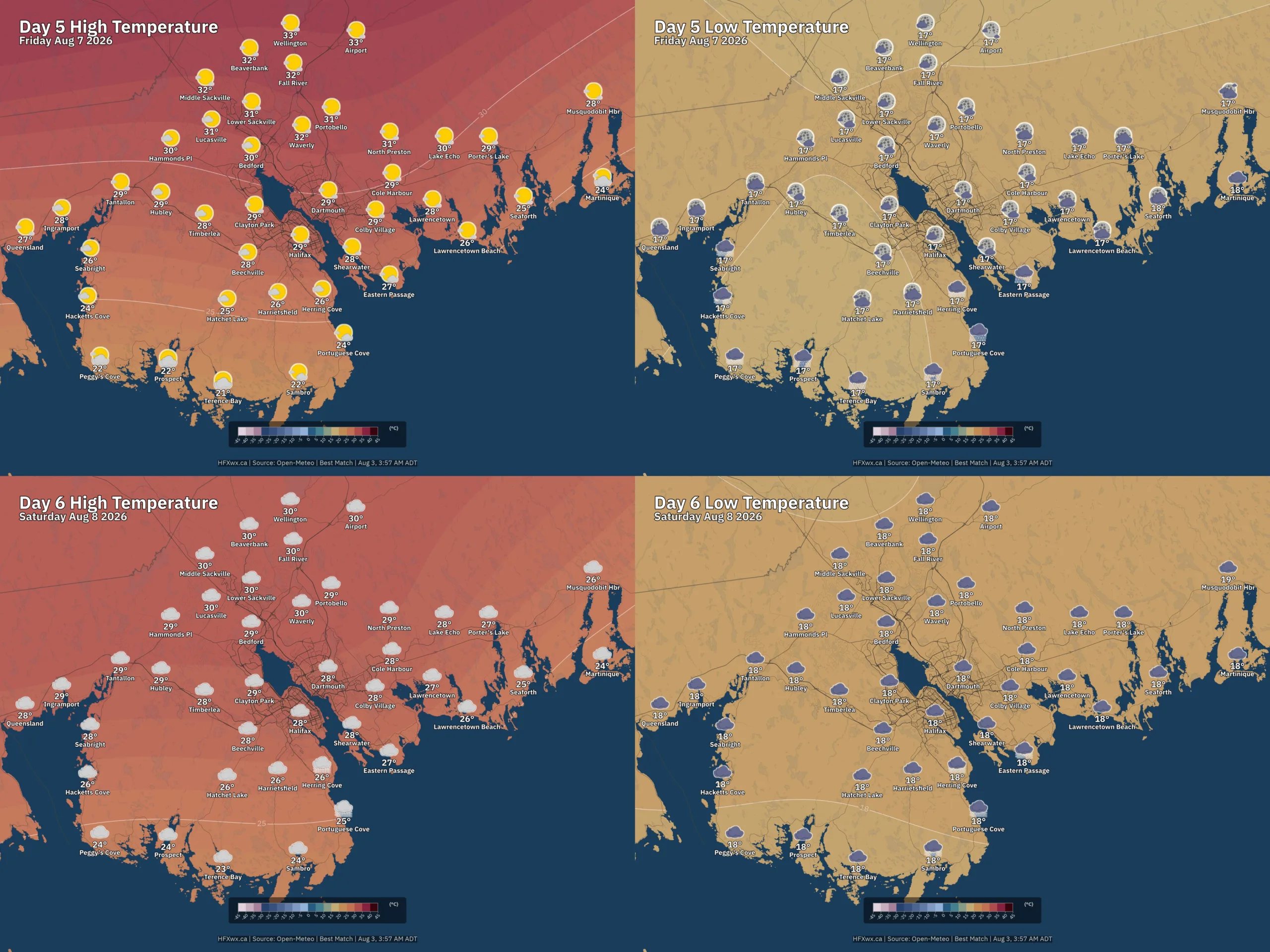
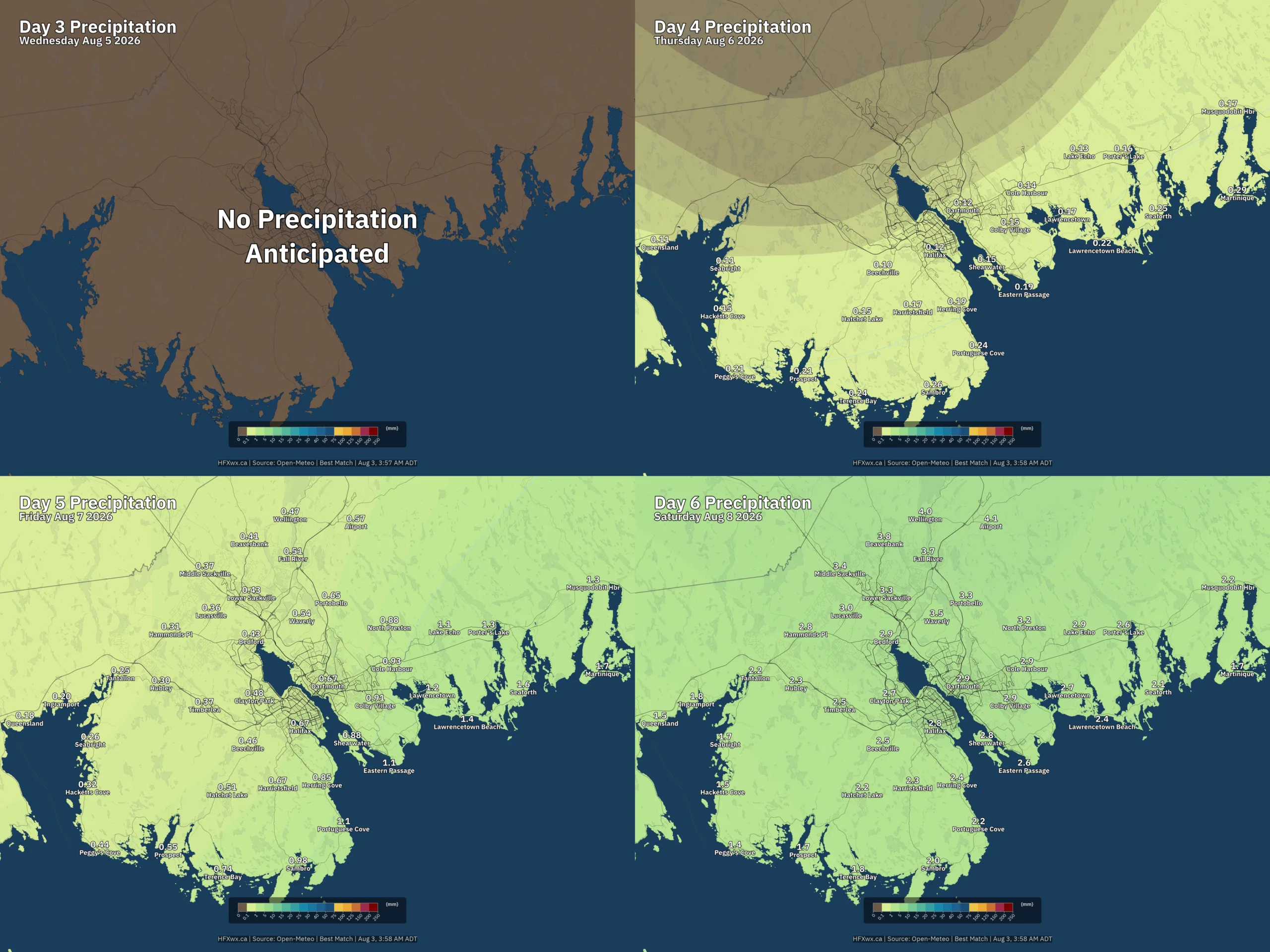
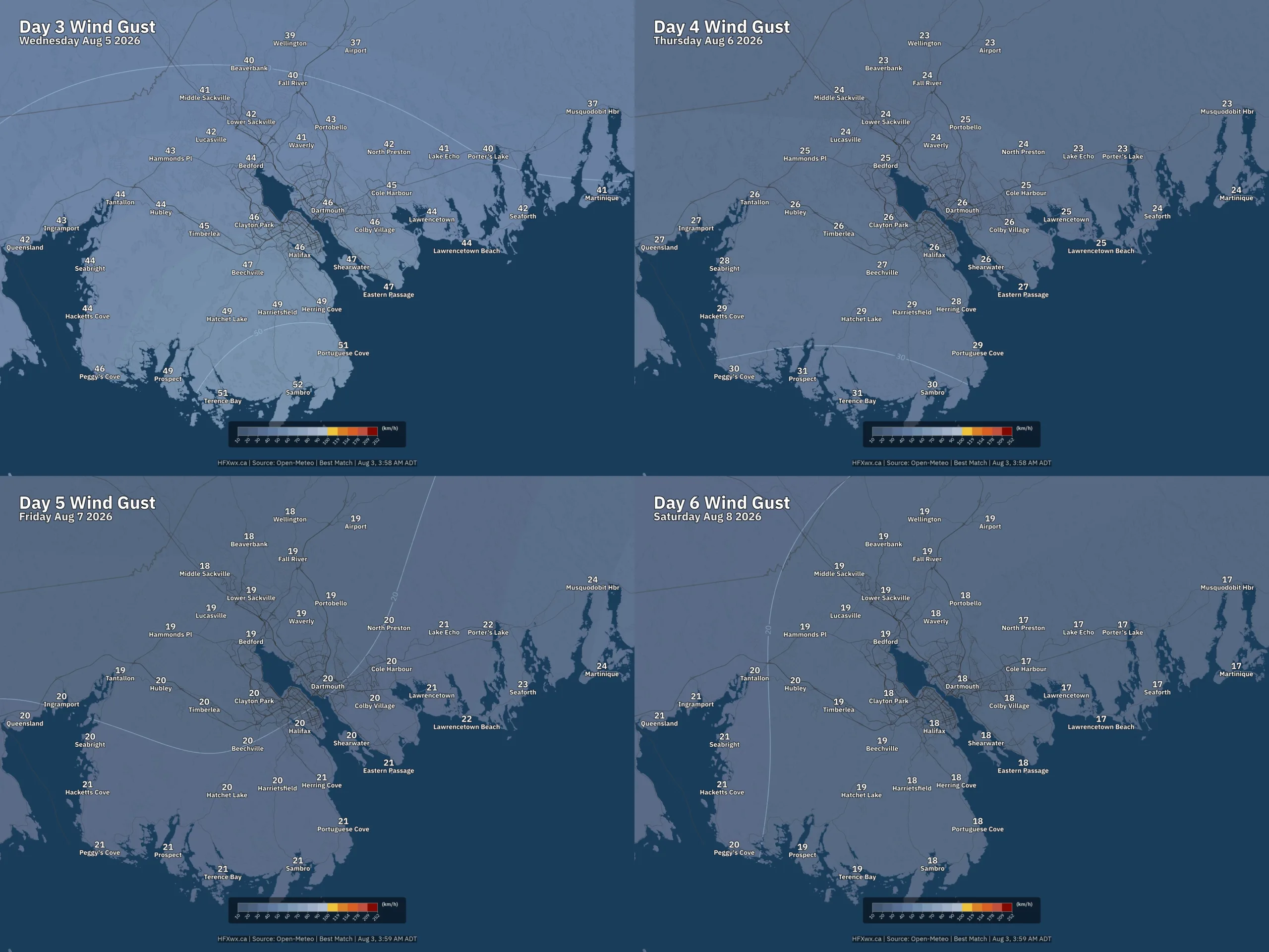
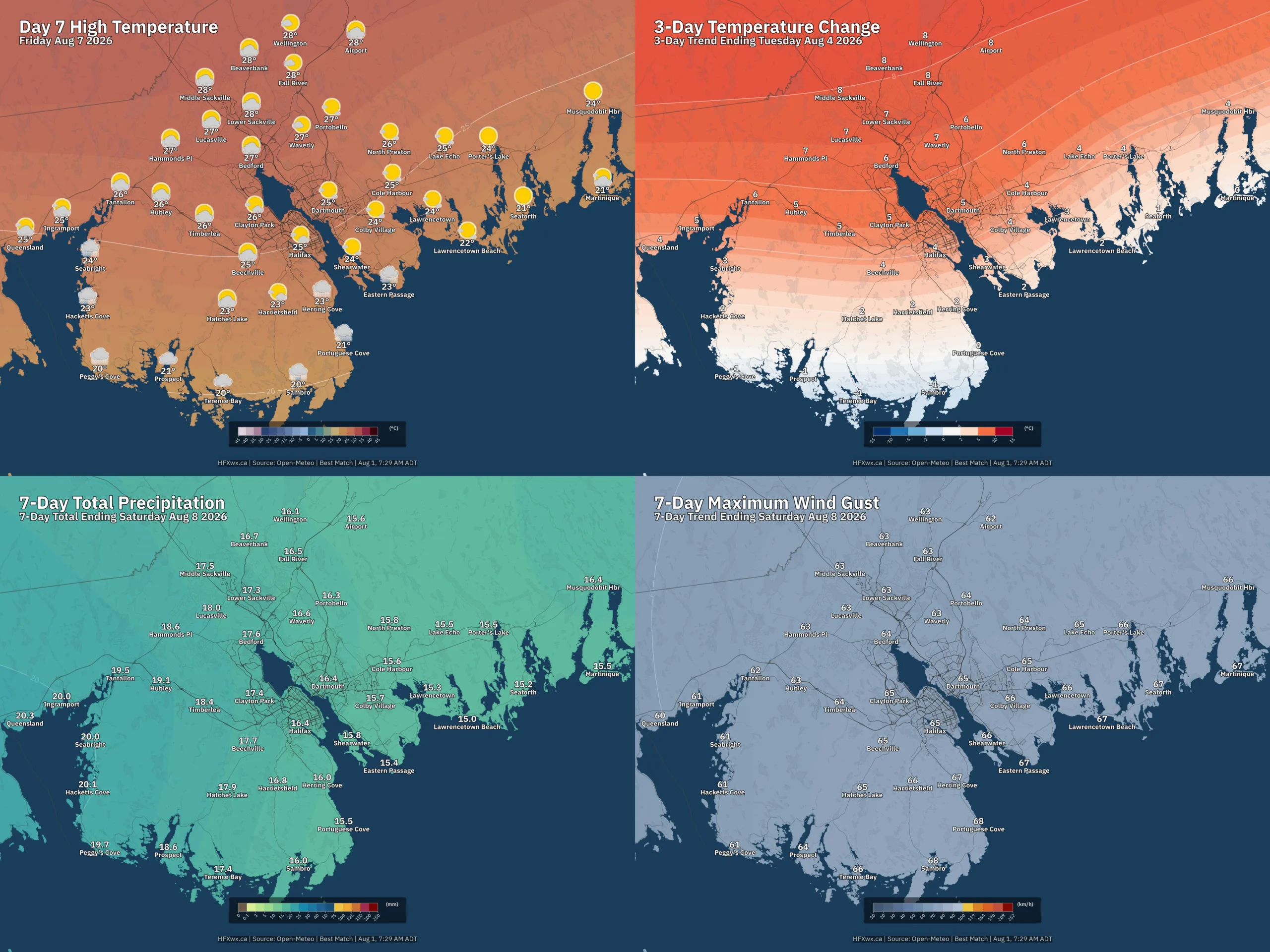
🗺️ Outlook and Trends: