🚨 Alert: Yellow Warning – Heat – In Effect

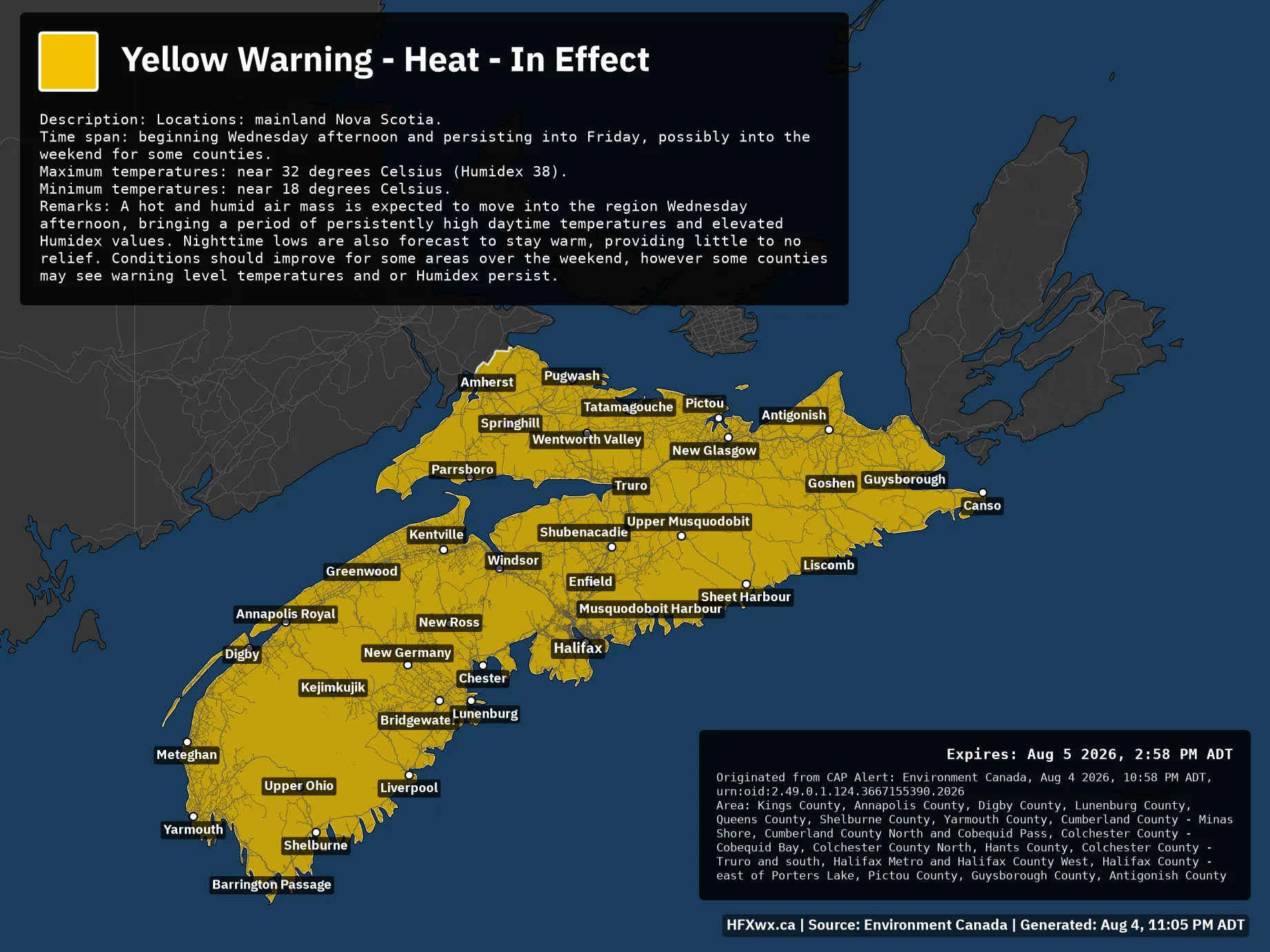
🟨🚨 Yellow Warning – Heat – In Effect Issued: Aug 4, 10:58 PM ADT Description: Locations: mainland Nova Scotia. Time span: beginning Wednesday afternoon and persisting into Friday, possibly into the weekend for some counties. Maximum temperatures: near 32 degrees Celsius (Humidex 38).Minimum temperatures: near 18 degrees Celsius. Remarks: A hot and humid air mass is expected to move into the region Wednesday afternoon, bringing a period of persistently high daytime temperatures and elevated Humidex values. Nighttime lows are also forecast to stay warm, providing little to no relief. Conditions should improve for some areas over the weekend, however some…
🚨 Alert: Yellow Warning – Heat – In Effect
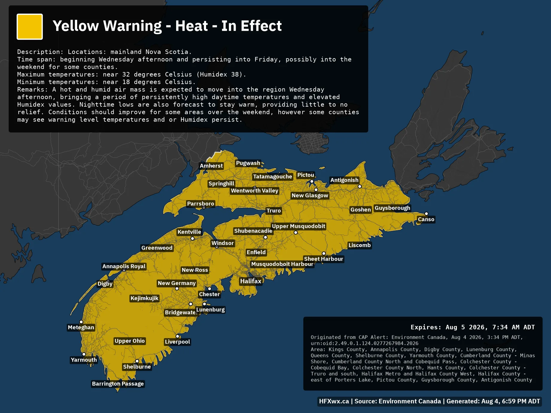
🟨🚨 Yellow Warning – Heat – In Effect Issued: Aug 4, 3:34 PM ADT Description: Locations: mainland Nova Scotia. Time span: beginning Wednesday afternoon and persisting into Friday, possibly into the weekend for some counties. Maximum temperatures: near 32 degrees Celsius (Humidex 38).Minimum temperatures: near 18 degrees Celsius. Remarks: A hot and humid air mass is expected to move into the region Wednesday afternoon, bringing a period of persistently high daytime temperatures and elevated Humidex values. Nighttime lows are also forecast to stay warm, providing little to no relief. Conditions should improve for some areas over the weekend, however some…
🚨 Alert: Les Suêtes Wind Warning
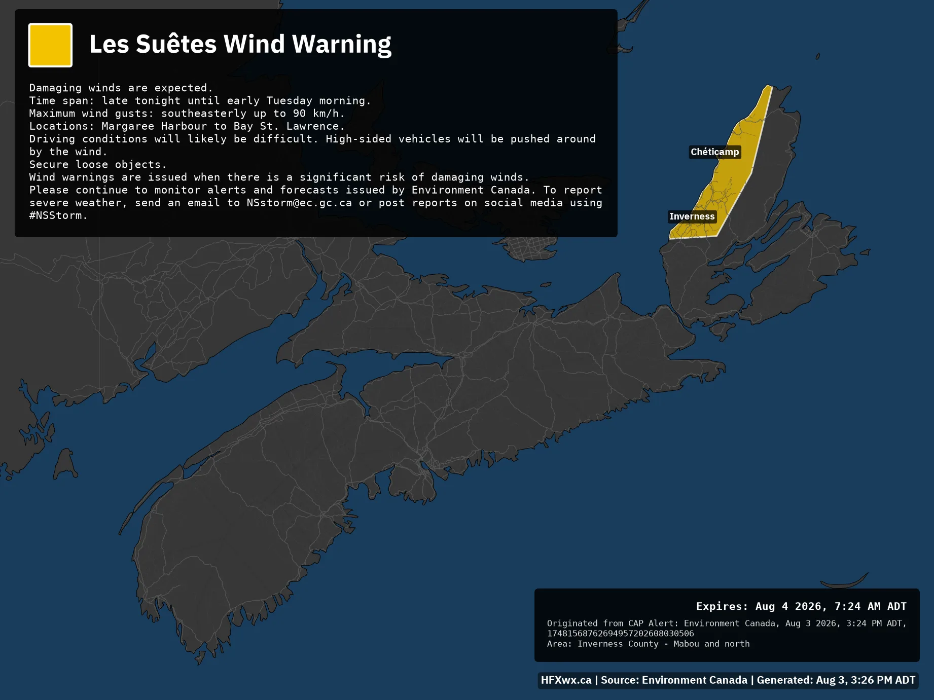
🟨🚨 Les Suêtes Wind Warning Issued: Aug 3, 3:24 PM ADT Damaging winds are expected. Time span: late tonight until early Tuesday morning. Maximum wind gusts: southeasterly up to 90 km/h. Locations: Margaree Harbour to Bay St. Lawrence. Driving conditions will likely be difficult. High-sided vehicles will be pushed around by the wind. Secure loose objects. Wind warnings are issued when there is a significant risk of damaging winds. Please continue to monitor alerts and forecasts issued by Environment Canada. To report severe weather, send an email to [email protected] or post reports on social media using #NSStorm.Expires: Aug 4 2026,…
🚨 Alert: Severe Thunderstorm Watch
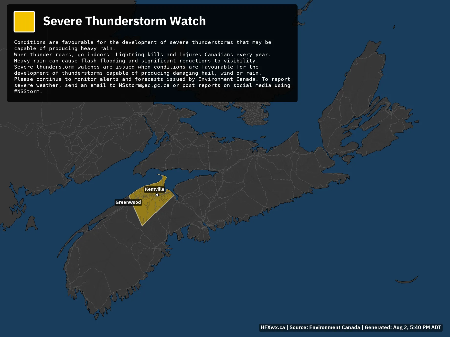
⬜⚠️ Severe Thunderstorm Watch Issued: Aug 2, 5:39 PM ADT Conditions are favourable for the development of severe thunderstorms that may be capable of producing heavy rain. When thunder roars, go indoors! Lightning kills and injures Canadians every year. Heavy rain can cause flash flooding and significant reductions to visibility. Severe thunderstorm watches are issued when conditions are favourable for the development of thunderstorms capable of producing damaging hail, wind or rain. Please continue to monitor alerts and forecasts issued by Environment Canada. To report severe weather, send an email to [email protected] or post reports on social media using #NSStorm.…
🚨 Alert: Yellow Watch – Severe Thunderstorm – In Effect
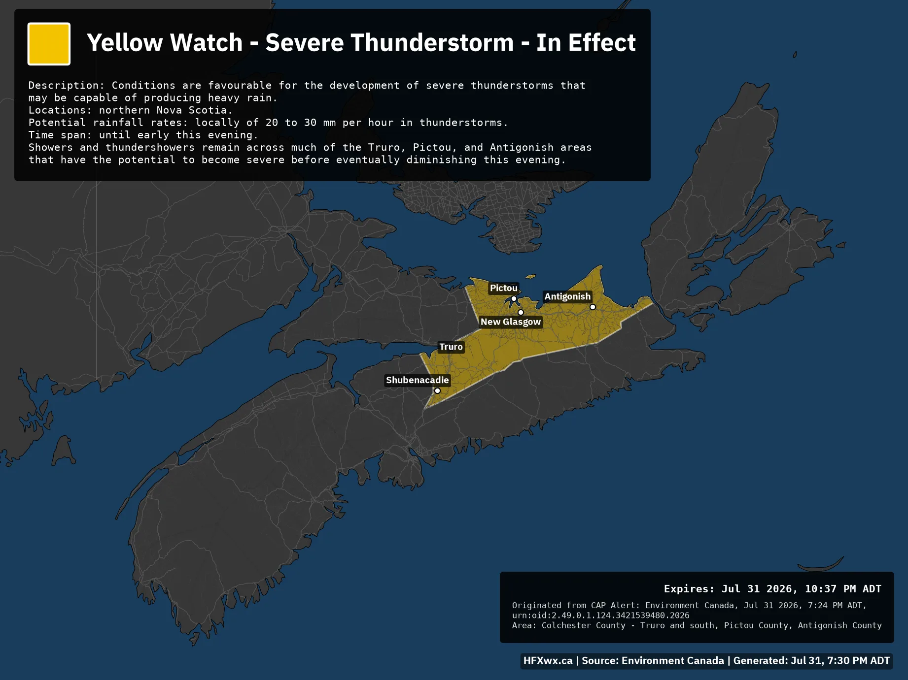
🟨⚠️ Yellow Watch – Severe Thunderstorm – In Effect Issued: Jul 31, 7:24 PM ADT Description: Conditions are favourable for the development of severe thunderstorms that may be capable of producing heavy rain. Locations: northern Nova Scotia. Potential rainfall rates: locally of 20 to 30 mm per hour in thunderstorms. Time span: until early this evening. Showers and thundershowers remain across much of the Truro, Pictou, and Antigonish areas that have the potential to become severe before eventually diminishing this evening. Expires: Jul 31 2026, 10:37 PM ADTOriginated from CAP Alert: Environment Canada, Jul 31 2026, 7:24 PM ADT, urn:oid:2.49.0.1.124.3421539480.2026Area:…
🚨 Alert: Yellow Warning – Severe Thunderstorm – In Effect
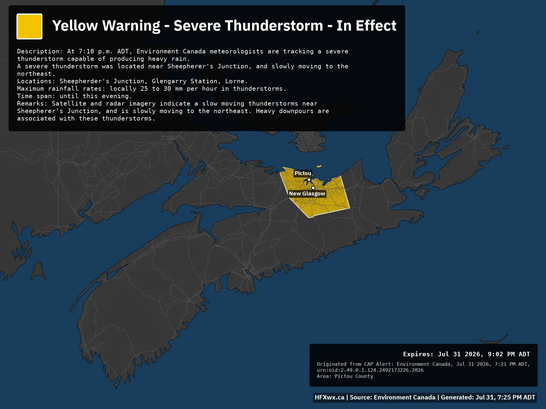
🟨🚨 Yellow Warning – Severe Thunderstorm – In Effect Issued: Jul 31, 7:21 PM ADT Description: At 7:18 p.m. ADT, Environment Canada meteorologists are tracking a severe thunderstorm capable of producing heavy rain. A severe thunderstorm was located near Sheepherer’s Junction, and slowly moving to the northeast. Locations: Sheepherder’s Junction, Glengarry Station, Lorne. Maximum rainfall rates: locally 25 to 30 mm per hour in thunderstorms. Time span: until this evening. Remarks: Satellite and radar imagery indicate a slow moving thunderstorms near Sheepherer’s Junction, and is slowly moving to the northeast. Heavy downpours are associated with these thunderstorms. Expires: Jul 31…
🚨 Alert: Yellow Warning – Severe Thunderstorm – In Effect
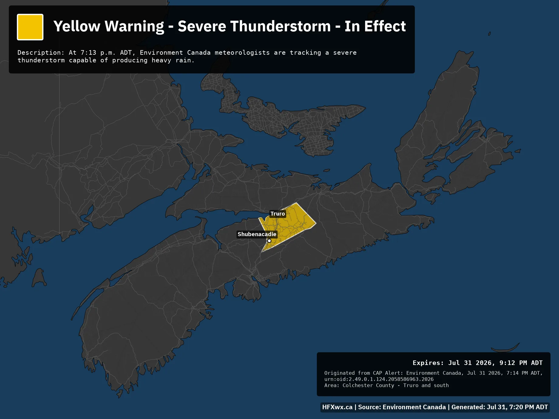
🟨🚨 Yellow Warning – Severe Thunderstorm – In Effect Issued: Jul 31, 7:14 PM ADT Description: At 7:13 p.m. ADT, Environment Canada meteorologists are tracking a severe thunderstorm capable of producing heavy rain. Expires: Jul 31 2026, 9:12 PM ADTOriginated from CAP Alert: Environment Canada, Jul 31 2026, 7:14 PM ADT, urn:oid:2.49.0.1.124.2058586963.2026Area: Colchester County – Truro and south View all active alerts from Environment Canada ➔
🚨 Alert: Yellow Warning – Severe Thunderstorm – In Effect
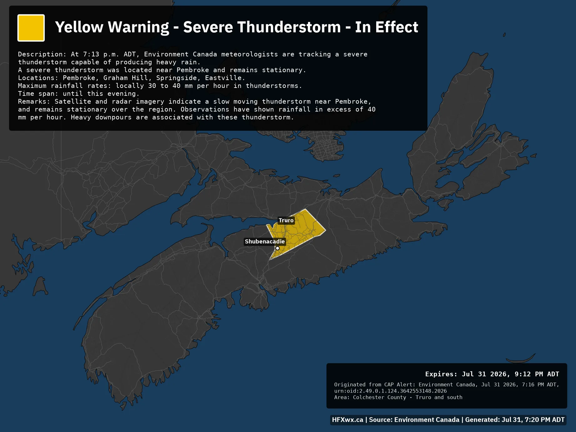
🟨🚨 Yellow Warning – Severe Thunderstorm – In Effect Issued: Jul 31, 7:16 PM ADT Description: At 7:13 p.m. ADT, Environment Canada meteorologists are tracking a severe thunderstorm capable of producing heavy rain. A severe thunderstorm was located near Pembroke and remains stationary. Locations: Pembroke, Graham Hill, Springside, Eastville. Maximum rainfall rates: locally 30 to 40 mm per hour in thunderstorms. Time span: until this evening. Remarks: Satellite and radar imagery indicate a slow moving thunderstorm near Pembroke, and remains stationary over the region. Observations have shown rainfall in excess of 40 mm per hour. Heavy downpours are associated with…
🚨 Alert: Yellow Warning – Severe Thunderstorm – In Effect
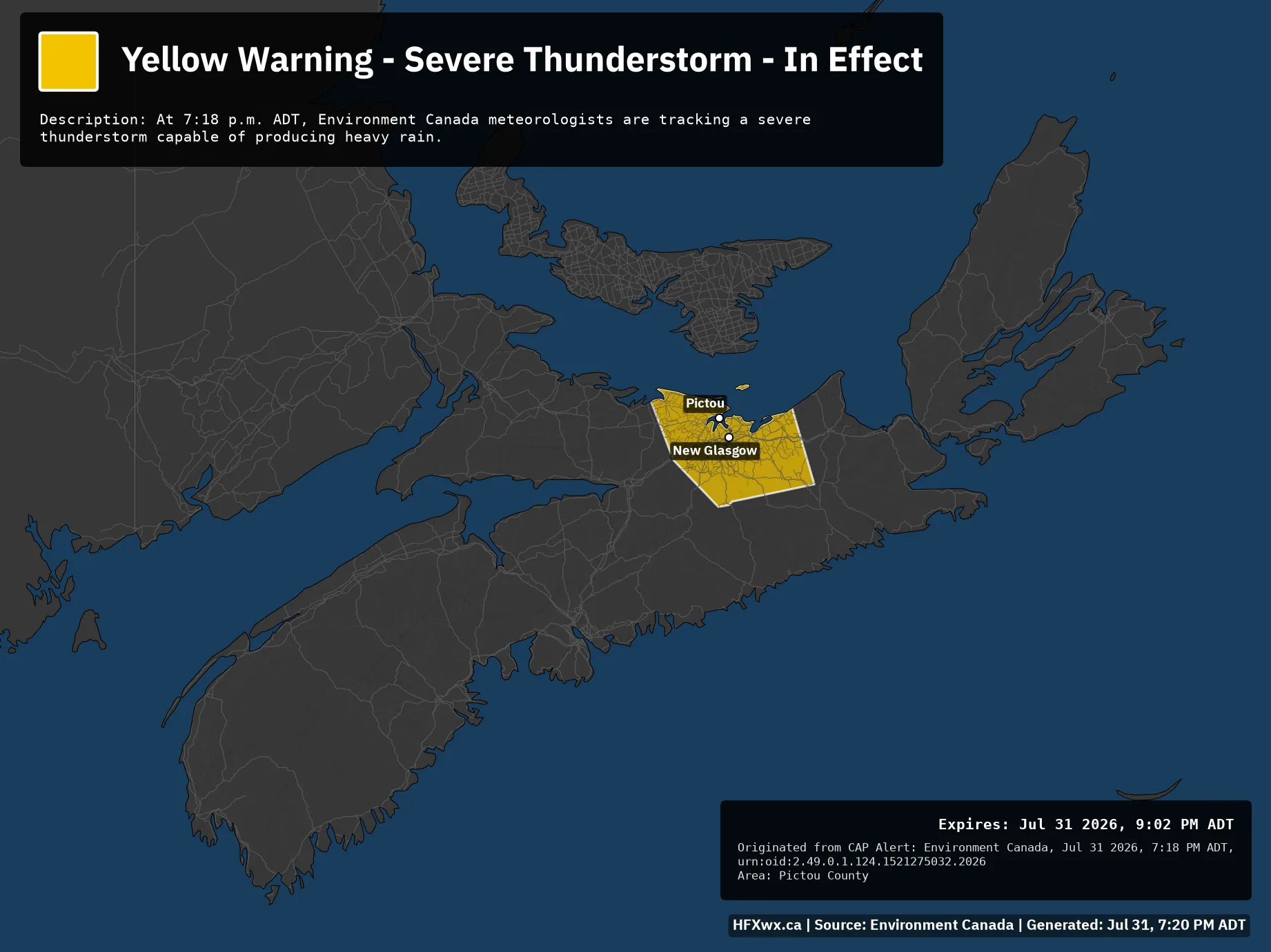
🟨🚨 Yellow Warning – Severe Thunderstorm – In Effect Issued: Jul 31, 7:18 PM ADT Description: At 7:18 p.m. ADT, Environment Canada meteorologists are tracking a severe thunderstorm capable of producing heavy rain. Expires: Jul 31 2026, 9:02 PM ADTOriginated from CAP Alert: Environment Canada, Jul 31 2026, 7:18 PM ADT, urn:oid:2.49.0.1.124.1521275032.2026Area: Pictou County View all active alerts from Environment Canada ➔
🚨 Alert: Yellow Watch – Severe Thunderstorm – In Effect
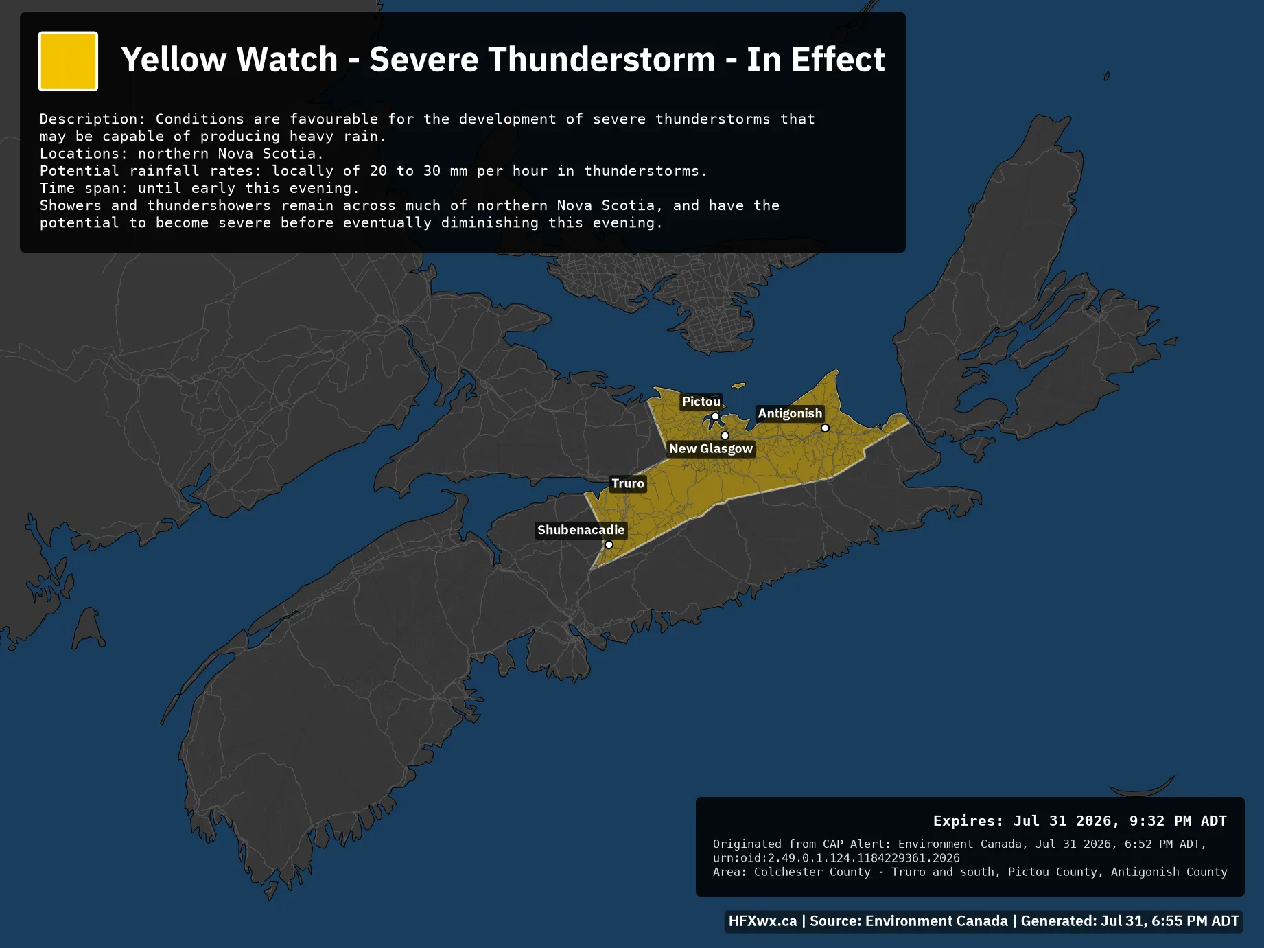
🟨⚠️ Yellow Watch – Severe Thunderstorm – In Effect Issued: Jul 31, 6:52 PM ADT Description: Conditions are favourable for the development of severe thunderstorms that may be capable of producing heavy rain. Locations: northern Nova Scotia. Potential rainfall rates: locally of 20 to 30 mm per hour in thunderstorms. Time span: until early this evening. Showers and thundershowers remain across much of northern Nova Scotia, and have the potential to become severe before eventually diminishing this evening. Expires: Jul 31 2026, 9:32 PM ADTOriginated from CAP Alert: Environment Canada, Jul 31 2026, 6:52 PM ADT, urn:oid:2.49.0.1.124.1184229361.2026Area: Colchester County –…

Halifax Weather