🚨 Alert: Yellow Warning – Severe Thunderstorm – In Effect

🟨🚨 Yellow Warning – Severe Thunderstorm – In Effect
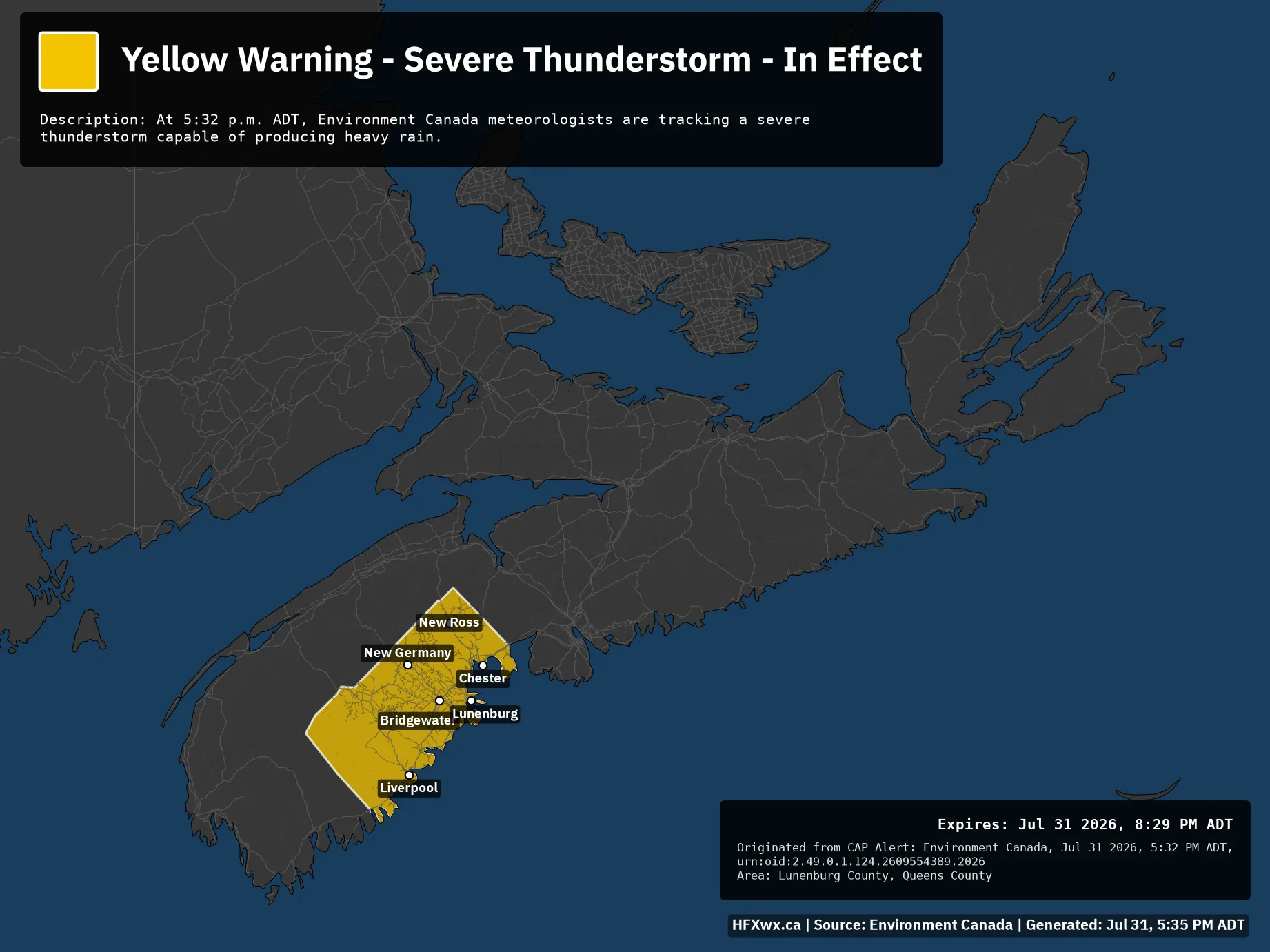
Issued: Jul 31, 5:32 PM ADT
Description: At 5:32 p.m. ADT, Environment Canada meteorologists are tracking a severe thunderstorm capable of producing heavy rain.

Expires: Jul 31 2026, 8:29 PM ADT
Originated from CAP Alert: Environment Canada, Jul 31 2026, 5:32 PM ADT, urn:oid:2.49.0.1.124.2609554389.2026
Area: Lunenburg County, Queens County
ALERT MAP

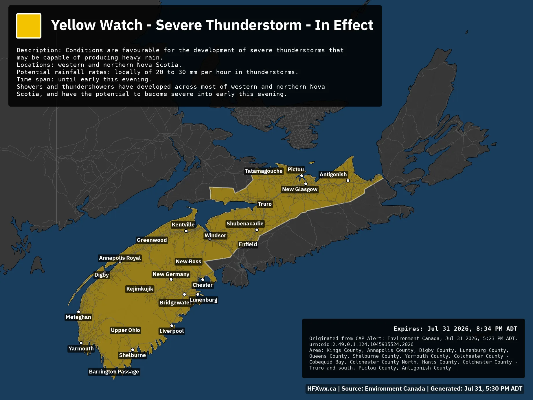
🚨 Alert: Yellow Watch – Severe Thunderstorm – In Effect

🟨⚠️ Yellow Watch – Severe Thunderstorm – In Effect
Issued: Jul 31, 5:23 PM ADT
Description: Conditions are favourable for the development of severe thunderstorms that may be capable of producing heavy rain.

Locations: western and northern Nova Scotia.

Potential rainfall rates: locally of 20 to 30 mm per hour in thunderstorms.

Time span: until early this evening.

Showers and thundershowers have developed across most of western and northern Nova Scotia, and have the potential to become severe into early this evening.

Expires: Jul 31 2026, 8:34 PM ADT
Originated from CAP Alert: Environment Canada, Jul 31 2026, 5:23 PM ADT, urn:oid:2.49.0.1.124.1045935524.2026
Area: Kings County, Annapolis County, Digby County, Lunenburg County, Queens County, Shelburne County, Yarmouth County, Colchester County – Cobequid Bay, Colchester County North, Hants County, Colchester County – Truro and south, Pictou County, Antigonish County

ALERT MAP

🚨 Alert: Yellow Warning – Severe Thunderstorm – In Effect

🟨🚨 Yellow Warning – Severe Thunderstorm – In Effect
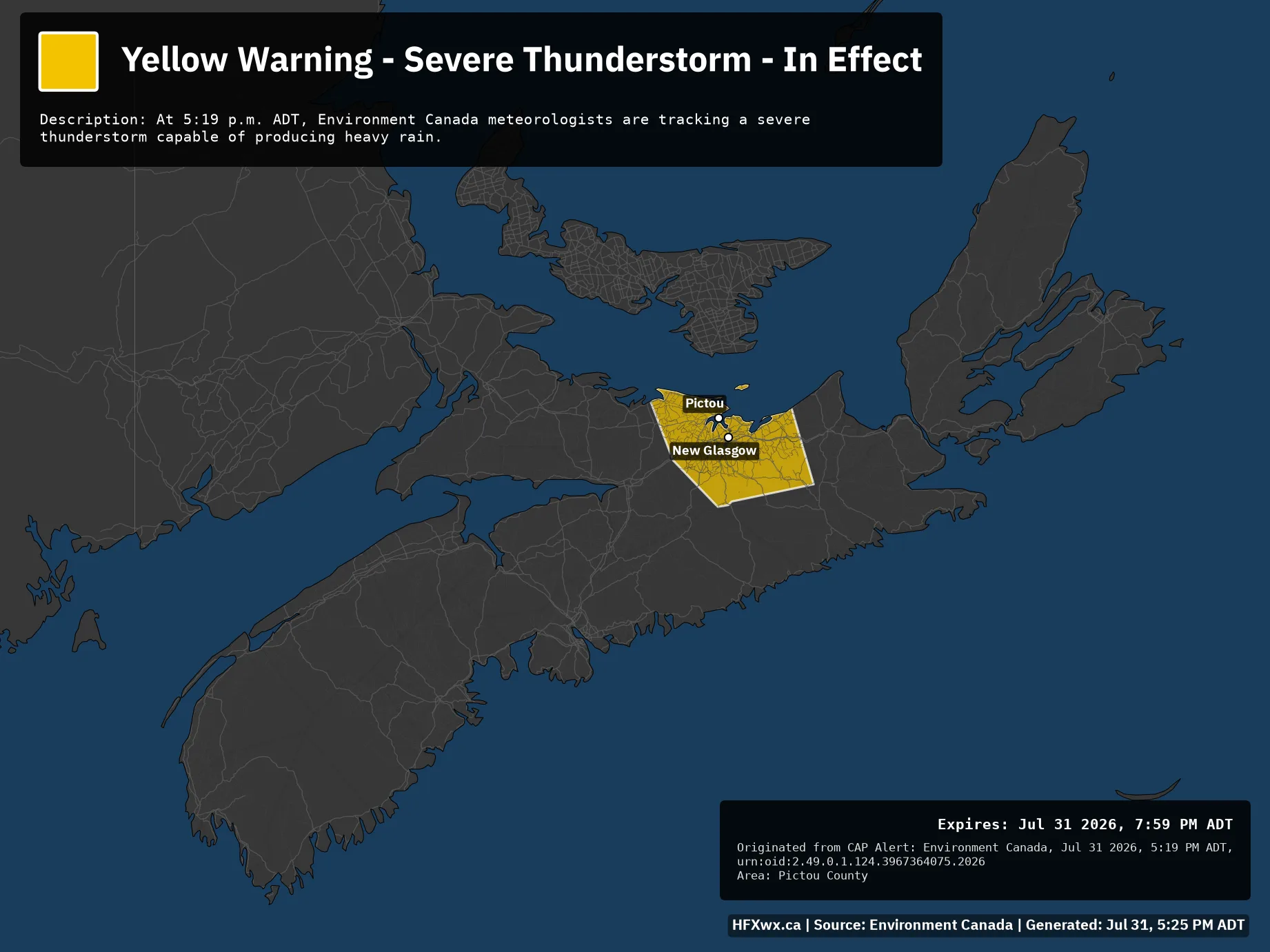
Issued: Jul 31, 5:19 PM ADT
Description: At 5:19 p.m. ADT, Environment Canada meteorologists are tracking a severe thunderstorm capable of producing heavy rain.

Expires: Jul 31 2026, 7:59 PM ADT
Originated from CAP Alert: Environment Canada, Jul 31 2026, 5:19 PM ADT, urn:oid:2.49.0.1.124.3967364075.2026
Area: Pictou County

ALERT MAP

🚨 Alert: Yellow Warning – Severe Thunderstorm – In Effect

🟨🚨 Yellow Warning – Severe Thunderstorm – In Effect
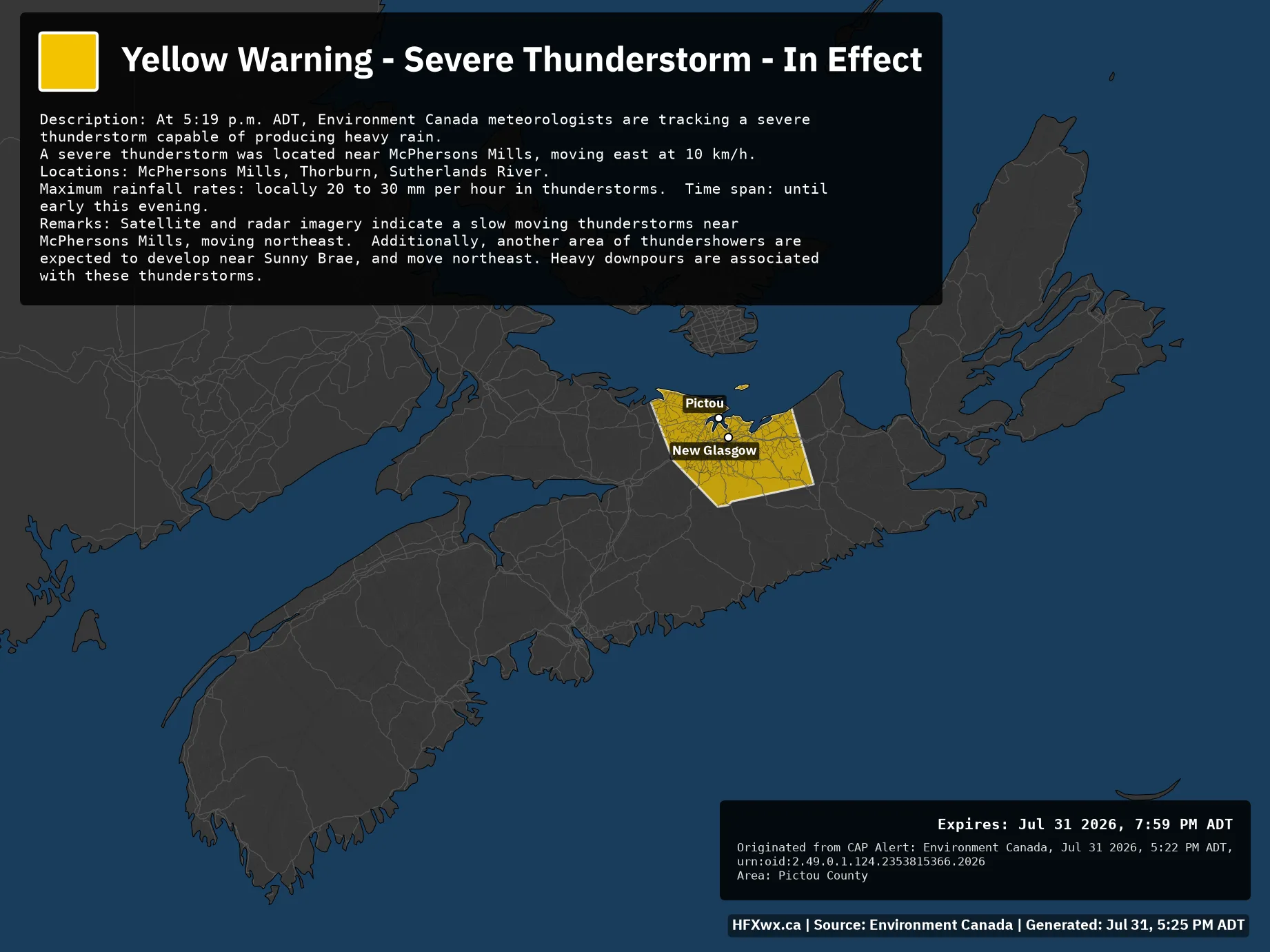
Issued: Jul 31, 5:22 PM ADT
Description: At 5:19 p.m. ADT, Environment Canada meteorologists are tracking a severe thunderstorm capable of producing heavy rain.

A severe thunderstorm was located near McPhersons Mills, moving east at 10 km/h.

Locations: McPhersons Mills, Thorburn, Sutherlands River.

Maximum rainfall rates: locally 20 to 30 mm per hour in thunderstorms. Time span: until early this evening.

Remarks: Satellite and radar imagery indicate a slow moving thunderstorms near McPhersons Mills, moving northeast. Additionally, another area of thundershowers are expected to develop near Sunny Brae, and move northeast. Heavy downpours are associated with these thunderstorms.

Expires: Jul 31 2026, 7:59 PM ADT
Originated from CAP Alert: Environment Canada, Jul 31 2026, 5:22 PM ADT, urn:oid:2.49.0.1.124.2353815366.2026
Area: Pictou County

ALERT MAP

🚨 Alert: Yellow Warning – Severe Thunderstorm – In Effect

🟨🚨 Yellow Warning – Severe Thunderstorm – In Effect
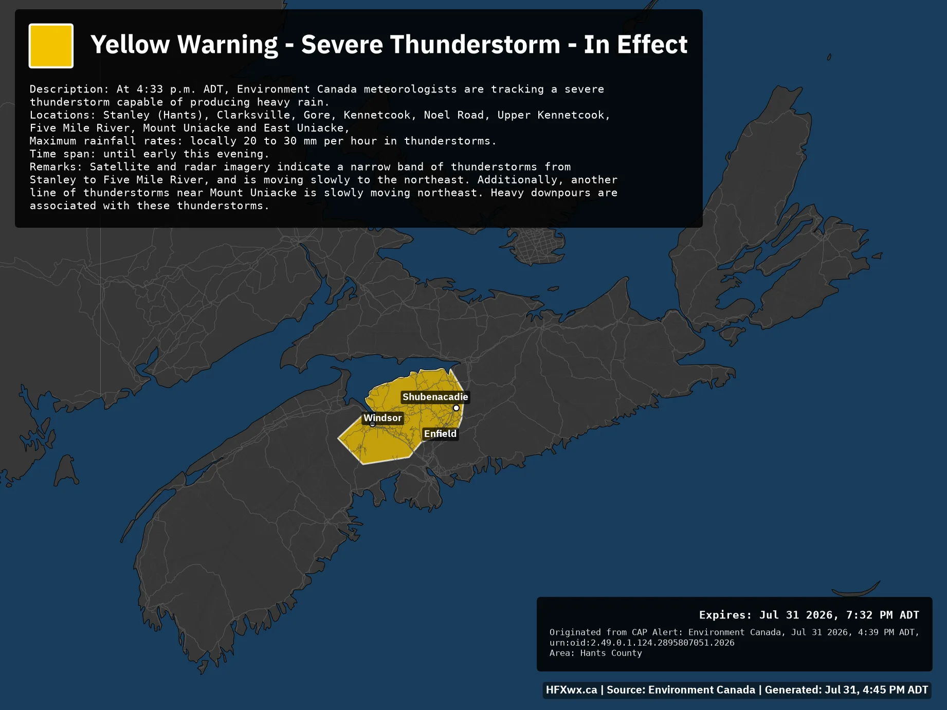
Issued: Jul 31, 4:39 PM ADT
Description: At 4:33 p.m. ADT, Environment Canada meteorologists are tracking a severe thunderstorm capable of producing heavy rain.

Locations: Stanley (Hants), Clarksville, Gore, Kennetcook, Noel Road, Upper Kennetcook, Five Mile River, Mount Uniacke and East Uniacke,

Maximum rainfall rates: locally 20 to 30 mm per hour in thunderstorms.

Time span: until early this evening.

Remarks: Satellite and radar imagery indicate a narrow band of thunderstorms from Stanley to Five Mile River, and is moving slowly to the northeast. Additionally, another line of thunderstorms near Mount Uniacke is slowly moving northeast. Heavy downpours are associated with these thunderstorms.

Expires: Jul 31 2026, 7:32 PM ADT
Originated from CAP Alert: Environment Canada, Jul 31 2026, 4:39 PM ADT, urn:oid:2.49.0.1.124.2895807051.2026
Area: Hants County

ALERT MAP