🚨 Alert: Yellow Warning – Severe Thunderstorm – In Effect

🟧🚨 Yellow Warning – Severe Thunderstorm – In Effect
Issued: Jul 16, 4:37 PM ADT
A line of severe thunderstorms was located from 6 kilometres northwest of Hillsburn to 20 kilometres northwest of Tiverton to 45 kilometres southwest of Seal Cove, moving east-southeast at 70 km/h. Hazards: – 90 km/h wind gusts. – Pea size hail. Locations impacted include: Digby, Annapolis Royal, East Ferry, Little River (Digby), Central Grove Provincial Park, Sandy Cove (Digby), Lake Midway Provincial Park, Centreville (Digby), Grosses Coques, Church Point, Belliveaus Cove, St
impacted include: Digby, Annapolis Royal, East Ferry, Little River (Digby), Central Grove Provincial Park, Sandy Cove (Digby), Lake Midway Provincial Park, Centreville (Digby), Grosses Coques, Church Point, Belliveaus Cove, St. Bernard, Weymouth North, Little Brook, and Comeauville.
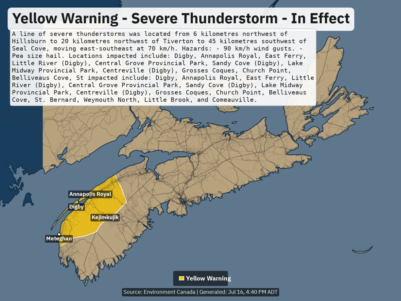
ALERT MAP

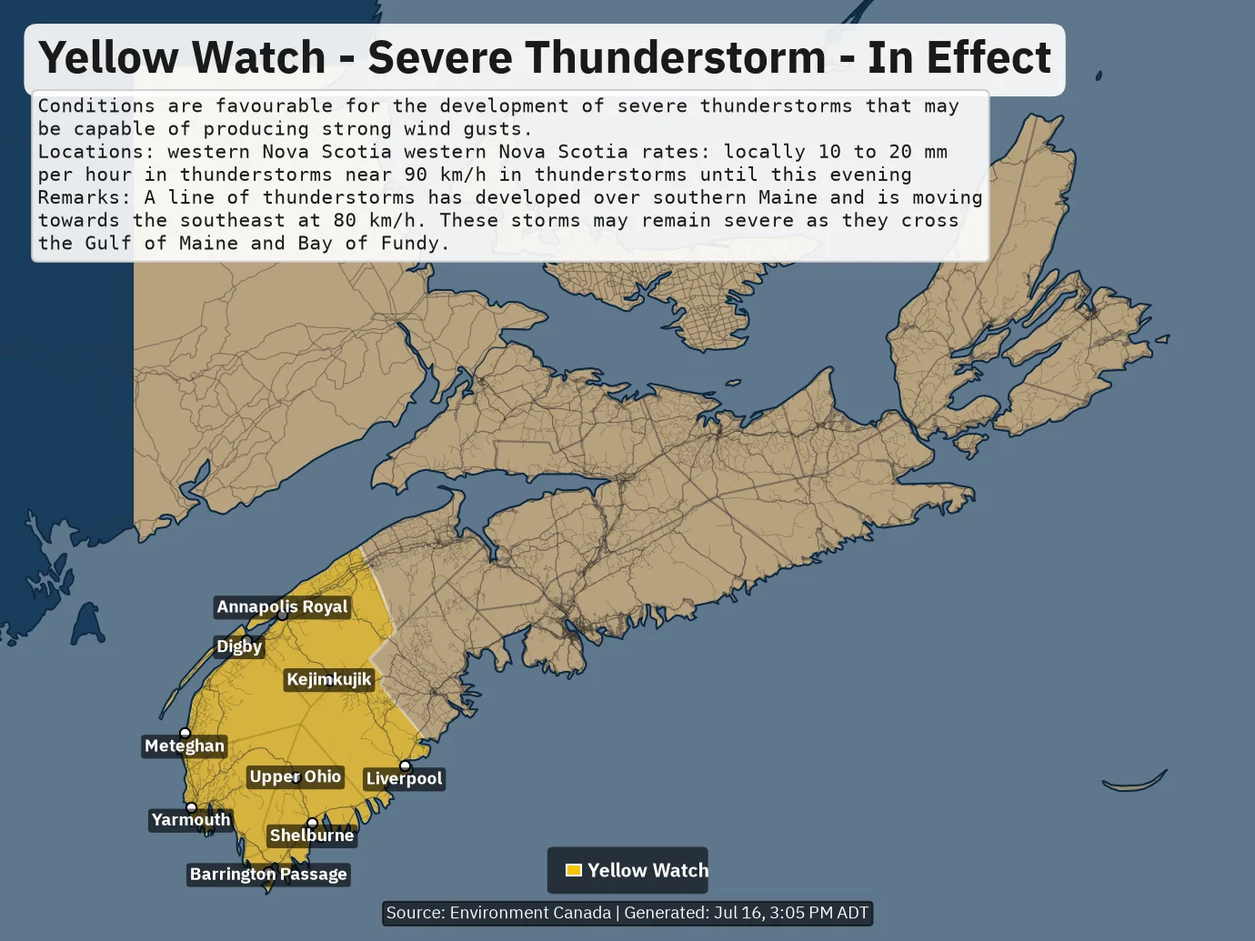
🚨 Alert: Yellow Watch – Severe Thunderstorm – In Effect

🟨⚠️ Yellow Watch – Severe Thunderstorm – In Effect
Issued: Jul 16, 3:03 PM ADT
Conditions are favourable for the development of severe thunderstorms that may be capable of producing strong wind gusts. Locations: western Nova Scotia
western Nova Scotia
rates: locally 10 to 20 mm per hour in thunderstorms
near 90 km/h in thunderstorms
until this evening
Remarks: A line of thunderstorms has developed over southern Maine and is moving towards the southeast at 80 km/h. These storms may remain severe as they cross the Gulf of Maine and Bay of Fundy.

ALERT MAP

🚨 Alert: Yellow Watch – Severe Thunderstorm – In Effect

🟨⚠️ Yellow Watch – Severe Thunderstorm – In Effect
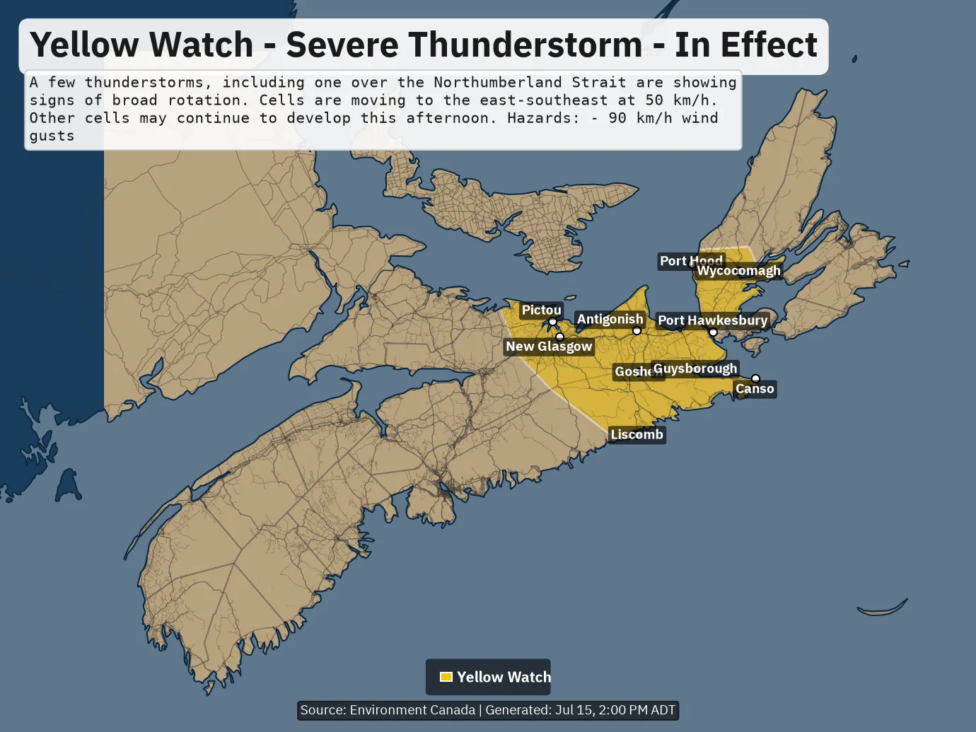
Issued: Jul 15, 1:55 PM ADT
A few thunderstorms, including one over the Northumberland Strait are showing signs of broad rotation. Cells are moving to the east-southeast at 50 km/h. Other cells may continue to develop this afternoon. Hazards: – 90 km/h wind gusts

ALERT MAP

🚨 Alert: Yellow Watch – Severe Thunderstorm – In Effect

🟨⚠️ Yellow Watch – Severe Thunderstorm – In Effect
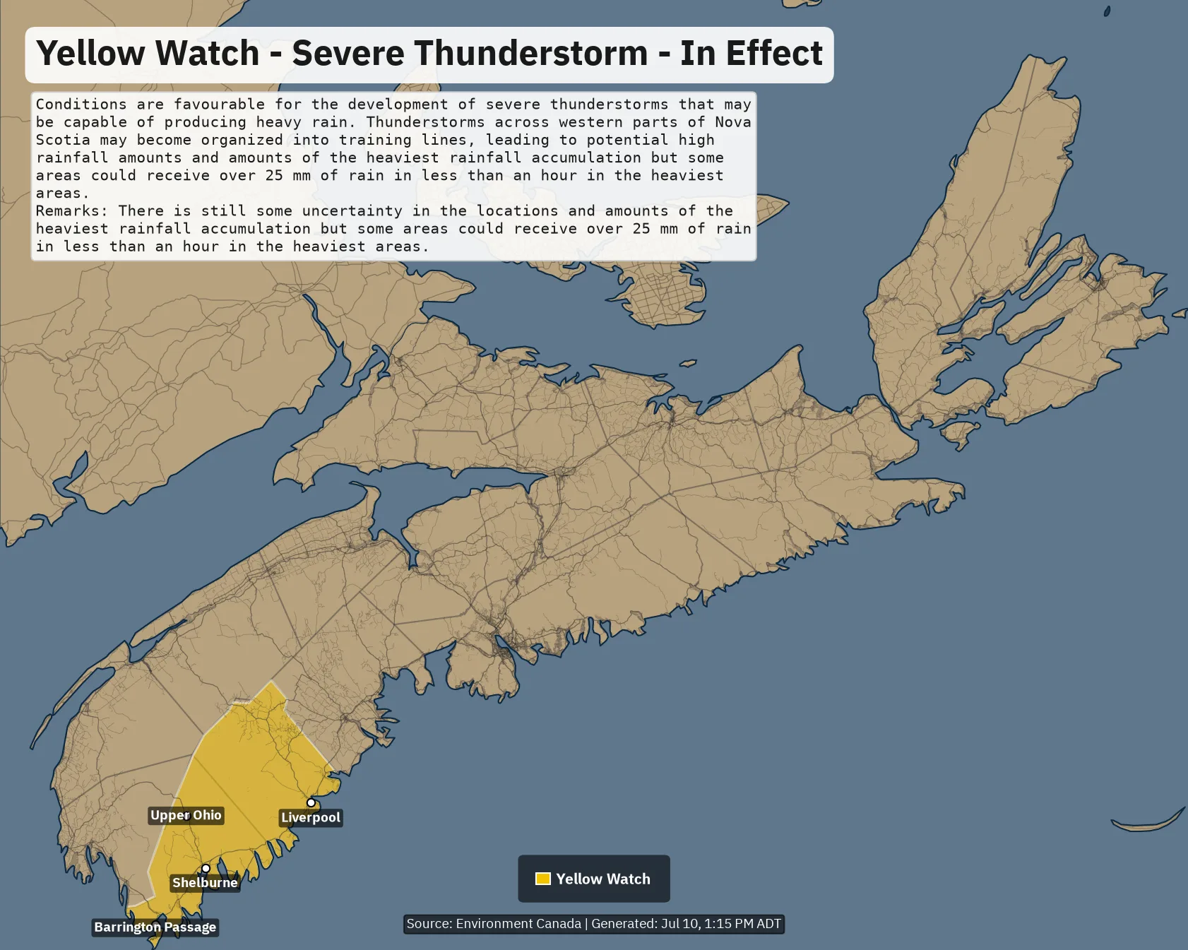
Issued: Jul 10, 1:12 PM ADT
Conditions are favourable for the development of severe thunderstorms that may be capable of producing heavy rain. Thunderstorms across western parts of Nova Scotia may become organized into training lines, leading to potential high rainfall amounts
and amounts of the heaviest rainfall accumulation but some areas could receive over 25 mm of rain in less than an hour in the heaviest areas.
Remarks: There is still some uncertainty in the locations and amounts of the heaviest rainfall accumulation but some areas could receive over 25 mm of rain in less than an hour in the heaviest areas.

ALERT MAP

🚨 Alert: Yellow Watch – Severe Thunderstorm – In Effect

🟨⚠️ Yellow Watch – Severe Thunderstorm – In Effect
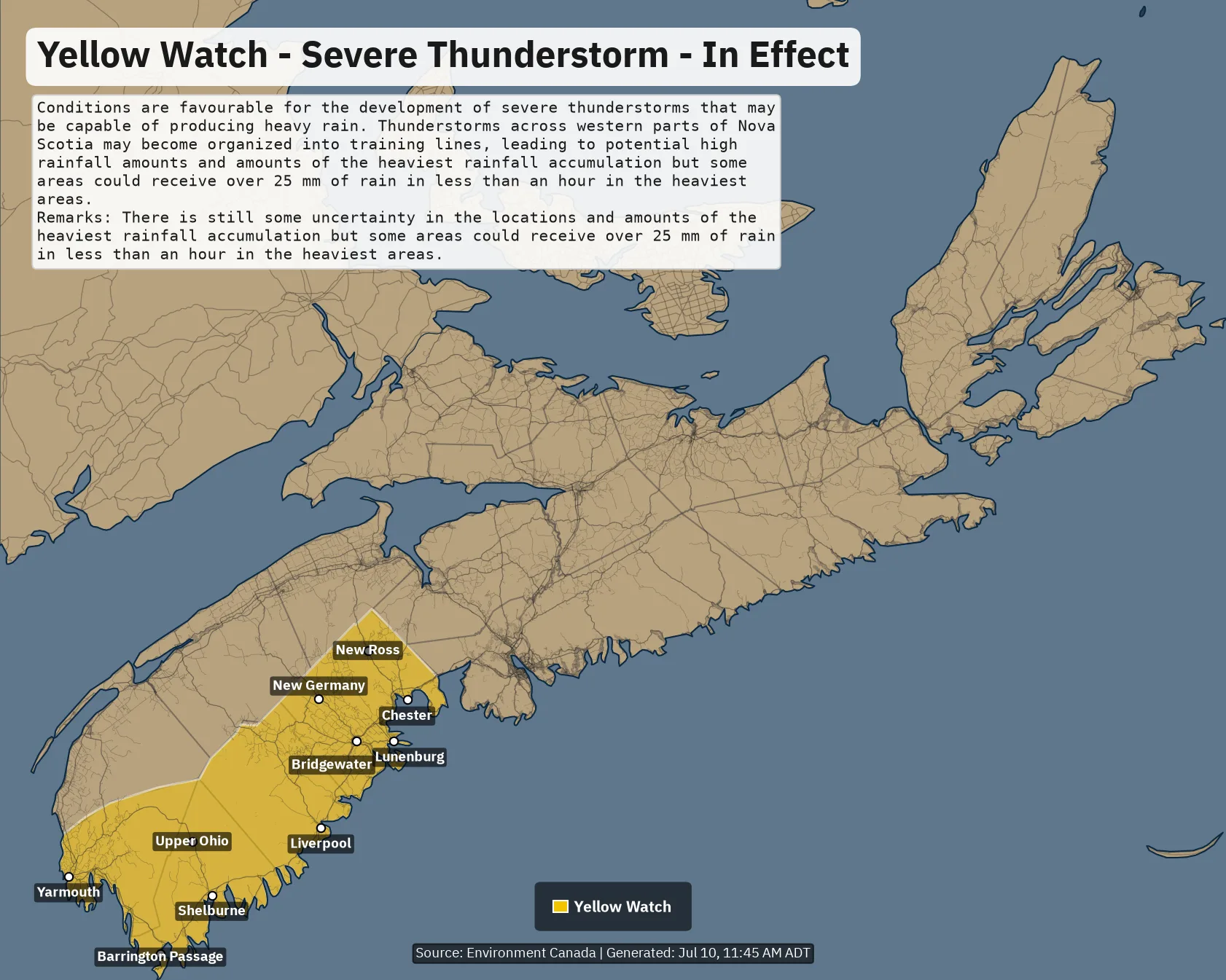
Issued: Jul 10, 11:41 AM ADT
Conditions are favourable for the development of severe thunderstorms that may be capable of producing heavy rain. Thunderstorms across western parts of Nova Scotia may become organized into training lines, leading to potential high rainfall amounts
and amounts of the heaviest rainfall accumulation but some areas could receive over 25 mm of rain in less than an hour in the heaviest areas.
Remarks: There is still some uncertainty in the locations and amounts of the heaviest rainfall accumulation but some areas could receive over 25 mm of rain in less than an hour in the heaviest areas.

ALERT MAP